MyTopo
Paddy Fay Creek Montana US Topo Map
Couldn't load pickup availability
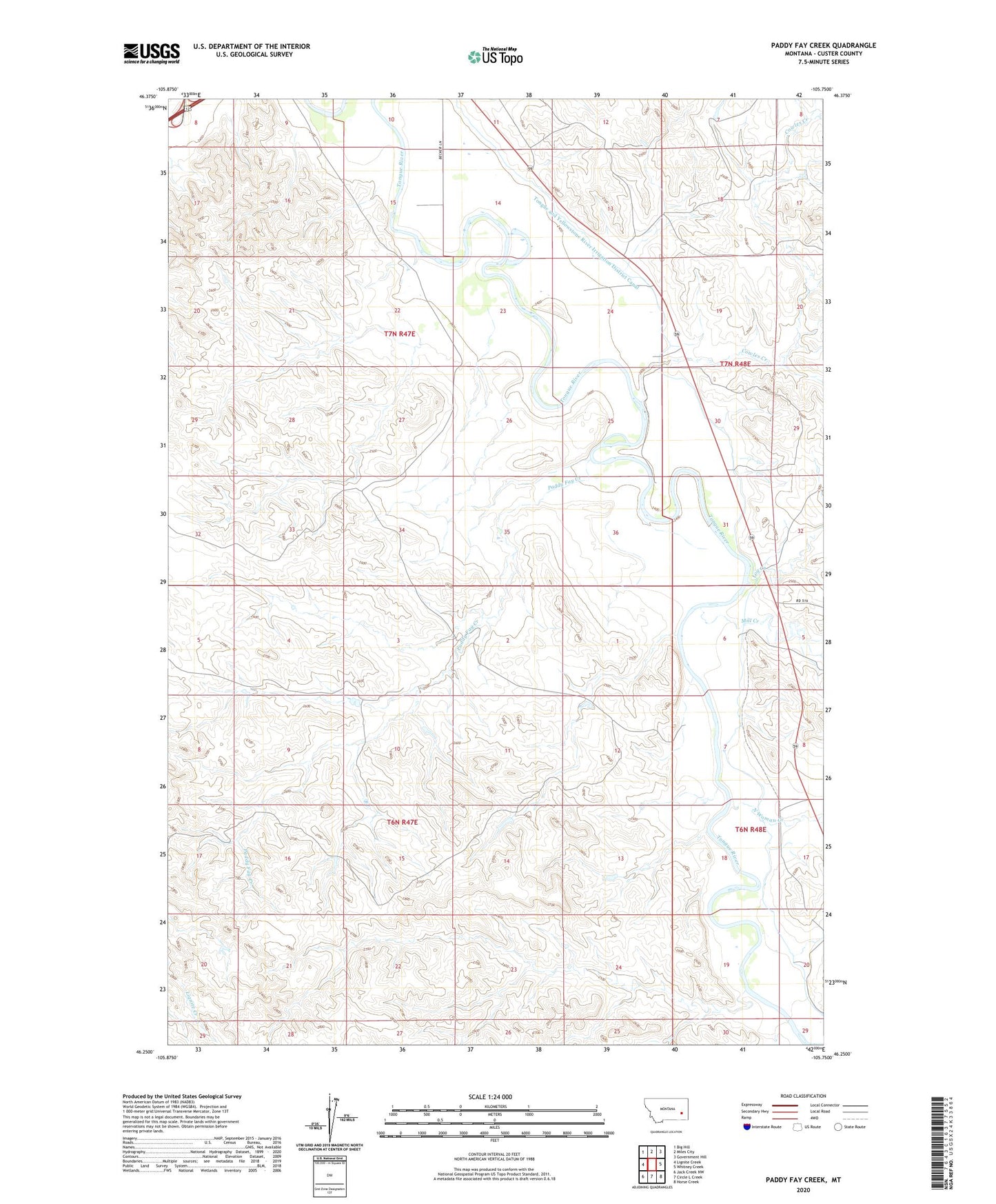
2024 topographic map quadrangle Paddy Fay Creek in the state of Montana. Scale: 1:24000. Based on the newly updated USGS 7.5' US Topo map series, this map is in the following counties: Custer. The map contains contour data, water features, and other items you are used to seeing on USGS maps, but also has updated roads and other features. This is the next generation of topographic maps. Printed on high-quality waterproof paper with UV fade-resistant inks.
Quads adjacent to this one:
West: Lignite Creek
Northwest: Big Hill
North: Miles City
Northeast: Government Hill
East: Whitney Creek
Southeast: Horse Creek
South: Circle L Creek
Southwest: Jack Creek NW
This map covers the same area as the classic USGS quad with code o46105c7.
Contains the following named places: 06N47E03ADDC01 Well, 06N47E23DABC01 Well, 06N48E08CCCA01 Well, 07N47E10DDAD01 Well, 07N47E13BBCC01 Well, 07N47E13DDBB01 Well, 07N47E24AAD_01 Well, 07N47E24CABB01 Well, 07N47E24DBAB01 Well, 07N47E36AABC01 Well, 07N47E36ADDD01 Well, 59301, Cowles Creek, Log Creek, Mill Creek, North Woman Creek, Paddy Fay Creek, Pumpkin Creek