MyTopo
Whitney Creek Montana US Topo Map
Couldn't load pickup availability
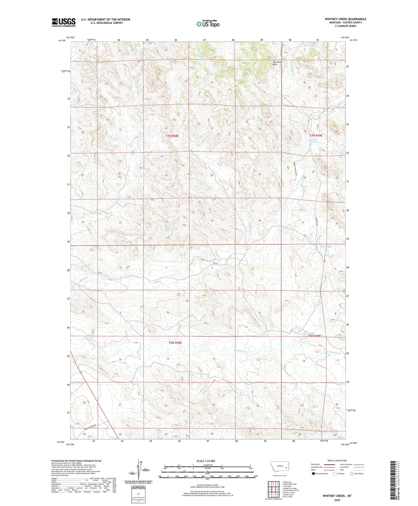
2024 topographic map quadrangle Whitney Creek in the state of Montana. Scale: 1:24000. Based on the newly updated USGS 7.5' US Topo map series, this map is in the following counties: Custer. The map contains contour data, water features, and other items you are used to seeing on USGS maps, but also has updated roads and other features. This is the next generation of topographic maps. Printed on high-quality waterproof paper with UV fade-resistant inks.
Quads adjacent to this one:
West: Paddy Fay Creek
Northwest: Miles City
North: Government Hill
Northeast: The Knob
East: Government Hill SE
Southeast: First Creek
South: Horse Creek
Southwest: Circle L Creek
This map covers the same area as the classic USGS quad with code o46105c6.
Contains the following named places: 06N48E14ABBB01 Well, 07N49E19ABC_01 Well, 07N49E30CBAC01 Well, Bircher Springs, East Fork Mill Creek, Finn Springs, Hirsch Number 1 Dam, Murray Number 1 Dam, West Fork Mill Creek