MyTopo
Coal Mine Hill Montana US Topo Map
Couldn't load pickup availability
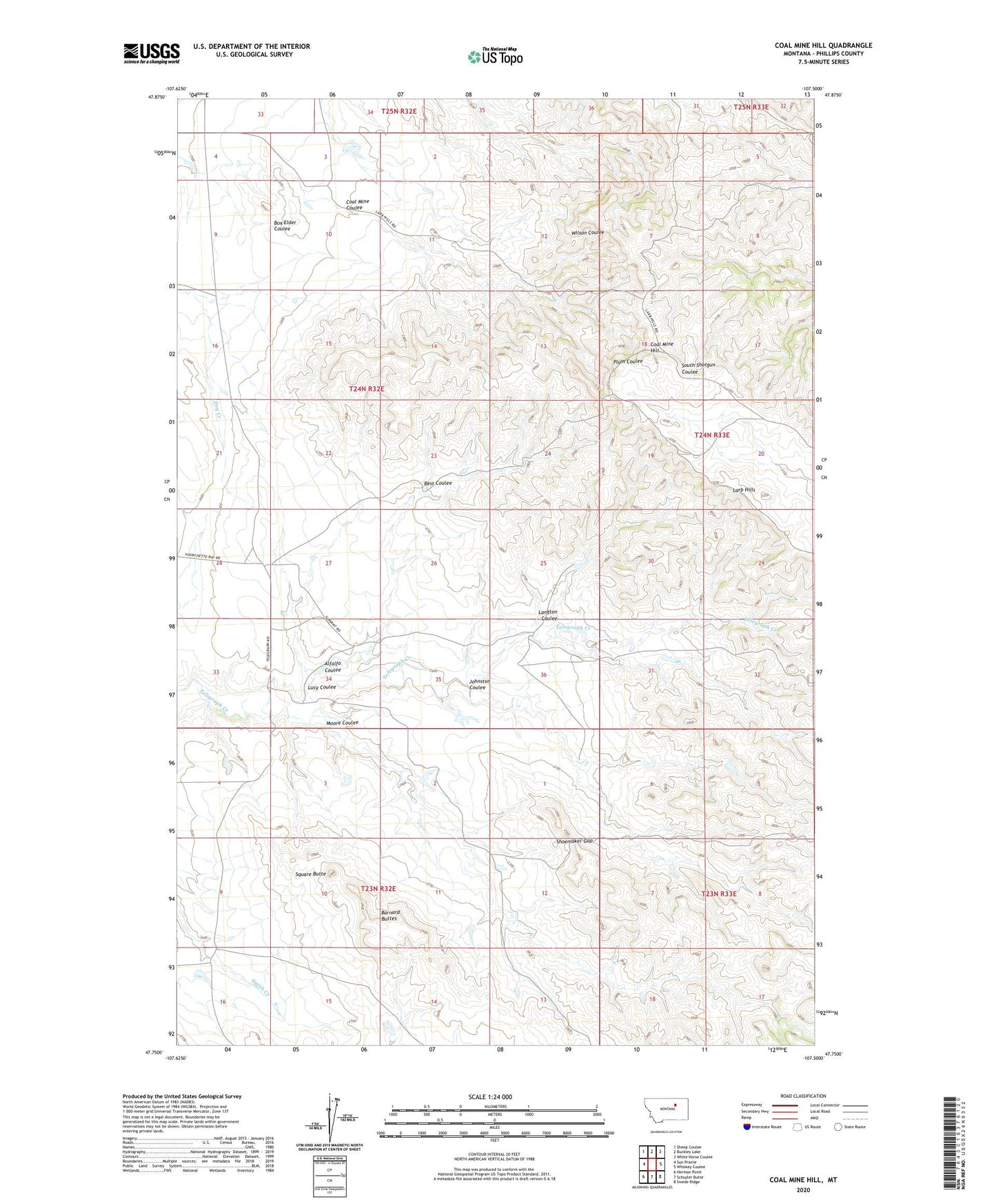
2020 topographic map quadrangle Coal Mine Hill in the state of Montana. Scale: 1:24000. Based on the newly updated USGS 7.5' US Topo map series, this map is in the following counties: Phillips. The map contains contour data, water features, and other items you are used to seeing on USGS maps, but also has updated roads and other features. This is the next generation of topographic maps. Printed on high-quality waterproof paper with UV fade-resistant inks.
Quads adjacent to this one:
West: Sun Prairie
Northwest: Sheep Coulee
North: Buckley Lake
Northeast: White Horse Coulee
East: Whiskey Coulee
Southeast: Swede Ridge
South: Schuyler Butte
Southwest: Herman Point
Contains the following named places: 01N33E16AAAD01 Well, 24N32E34DB__01 Well, Alfalfa Coulee, Barnard Buttes, Barnard Ranch, Best Coulee, Coal Mine Coulee, Coal Mine Hill, Johnston Coulee, Kelso Number 5 Dam, Langton Coulee, Larb Hill School, Larb Hills, Lucy Coulee, Moore Coulee, Shoemaker Gap, Spencer Ranch, Spencer School, Square Butte