MyTopo
Herman Point Montana US Topo Map
Couldn't load pickup availability
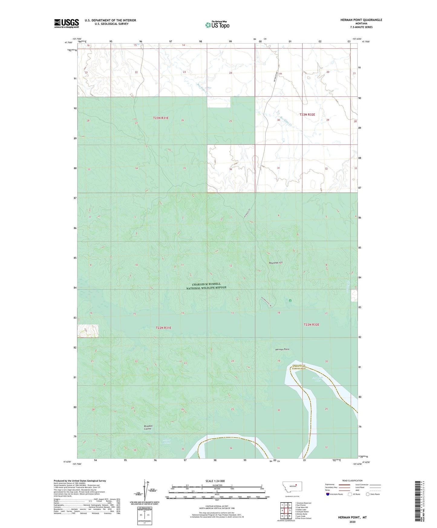
2024 topographic map quadrangle Herman Point in the state of Montana. Scale: 1:24000. Based on the newly updated USGS 7.5' US Topo map series, this map is in the following counties: Phillips, Garfield. The map contains contour data, water features, and other items you are used to seeing on USGS maps, but also has updated roads and other features. This is the next generation of topographic maps. Printed on high-quality waterproof paper with UV fade-resistant inks.
Quads adjacent to this one:
West: Indian Lake
Northwest: Stratton Reservoir
North: Sun Prairie
Northeast: Coal Mine Hill
East: Schuyler Butte
Southeast: Pine Grove School
South: Lost Creek
Southwest: Mickey Butte
This map covers the same area as the classic USGS quad with code o47107f6.
Contains the following named places: Bates Point, Brandon Coulee, Cottonwood Grazing Number 2 Dam, Fort Fourchette, Fourchette Creek Campground, Fourchette Creek Recreation Area, Herman Point, Johnny Creek, Pauchet Post Office, Point au Pauchet, Reynolds Hill, Skibby Bottom