MyTopo
Buckley Lake Montana US Topo Map
Couldn't load pickup availability
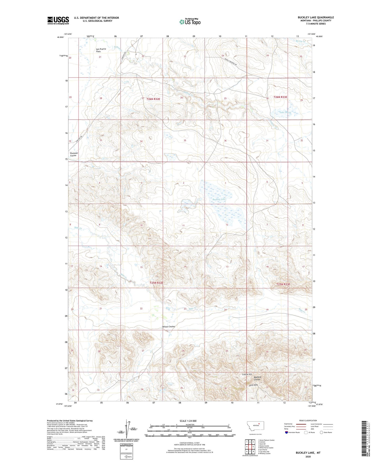
2024 topographic map quadrangle Buckley Lake in the state of Montana. Scale: 1:24000. Based on the newly updated USGS 7.5' US Topo map series, this map is in the following counties: Phillips. The map contains contour data, water features, and other items you are used to seeing on USGS maps, but also has updated roads and other features. This is the next generation of topographic maps. Printed on high-quality waterproof paper with UV fade-resistant inks.
Quads adjacent to this one:
West: Sheep Coulee
Northwest: Horse Pasture Coulee
North: Content
Northeast: Harb SW
East: White Horse Coulee
Southeast: Whiskey Coulee
South: Coal Mine Hill
Southwest: Sun Prairie
This map covers the same area as the classic USGS quad with code o47107h5.
Contains the following named places: 25N32E04AA__01 Well, 26N32E26ACB_01 Well, Buckley Lake, Collins Hill, Lake PR-19, Plummer Coulee, PR-139 Dam, PR-19 Dam, Resettlement FSA Number 2 Dam, Tallow Creek School, Wilson Coulee