MyTopo
Cox Butte Montana US Topo Map
Couldn't load pickup availability
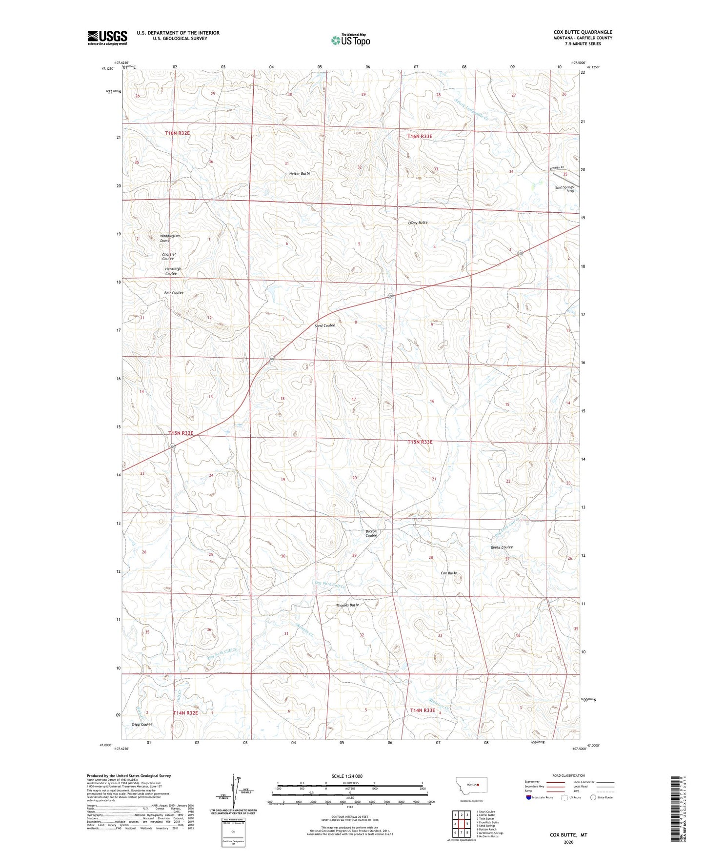
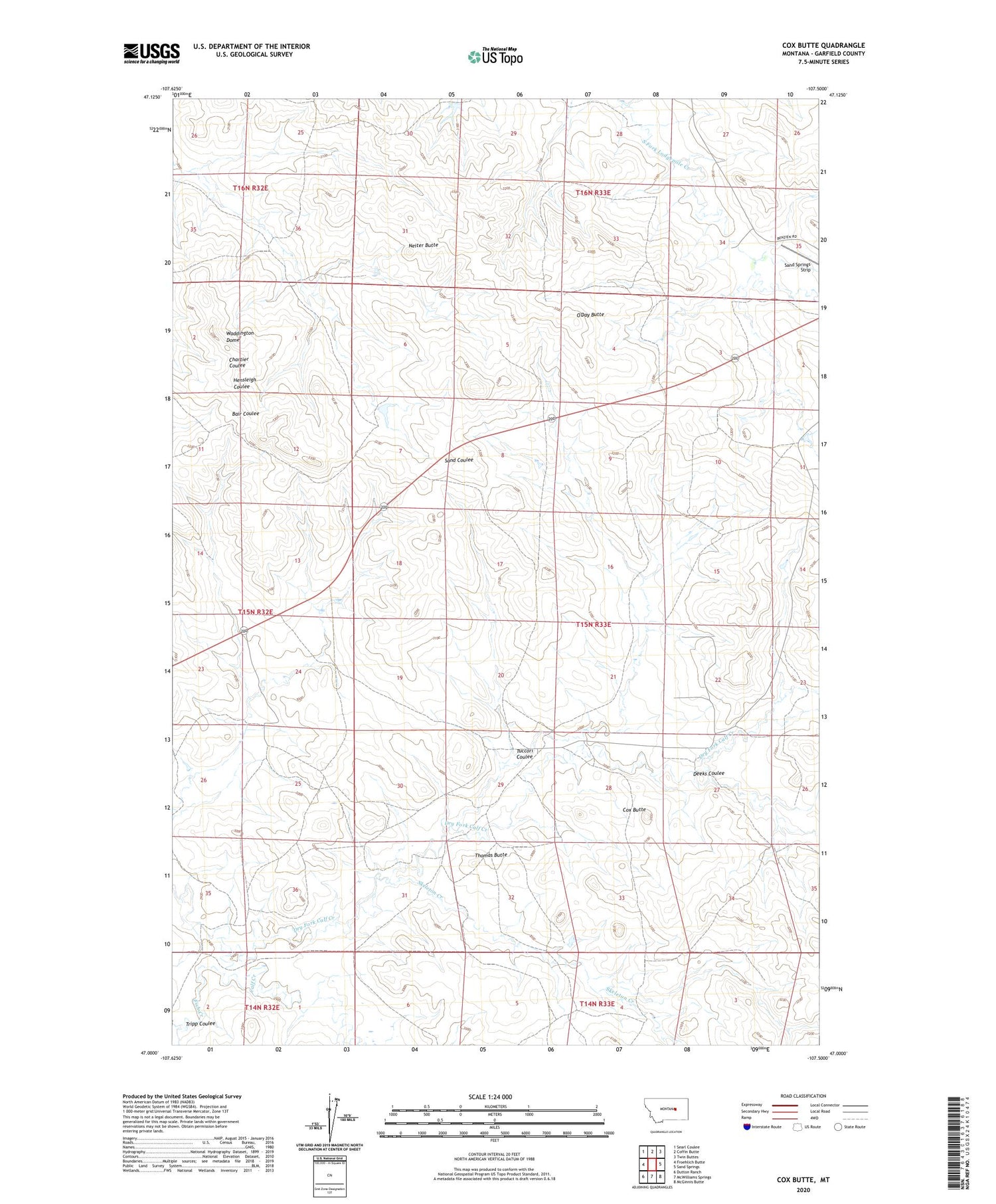
2020 topographic map quadrangle Cox Butte in the state of Montana. Scale: 1:24000. Based on the newly updated USGS 7.5' US Topo map series, this map is in the following counties: Garfield. The map contains contour data, water features, and other items you are used to seeing on USGS maps, but also has updated roads and other features. This is the next generation of topographic maps. Printed on high-quality waterproof paper with UV fade-resistant inks.
Quads adjacent to this one:
West: Froehlich Butte
Northwest: Searl Coulee
North: Coffin Butte
Northeast: Twin Buttes
East: Sand Springs
Southeast: McGinnis Butte
South: McWilliams Springs
Southwest: Dutton Ranch
Contains the following named places: Brown Number 3 Dam, Chimney Crossing, Cox Butte, Deeks Coulee, Dry Fork Calf Creek, Fish Creek, Neiter Butte, O'Day Butte, Sand Springs Strip, Skeleton Creek, Thomas Butte, Thomas School, Tripp Coulee, Tuccori Coulee, Waddington Dome