MyTopo
Searl Coulee Montana US Topo Map
Couldn't load pickup availability
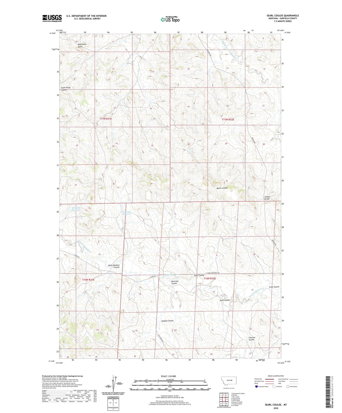
2024 topographic map quadrangle Searl Coulee in the state of Montana. Scale: 1:24000. Based on the newly updated USGS 7.5' US Topo map series, this map is in the following counties: Garfield. The map contains contour data, water features, and other items you are used to seeing on USGS maps, but also has updated roads and other features. This is the next generation of topographic maps. Printed on high-quality waterproof paper with UV fade-resistant inks.
Quads adjacent to this one:
West: Lelig Coulee
Northwest: Seventynine Coulee
North: Benzien
Northeast: Hay Coulee
East: Coffin Butte
Southeast: Cox Butte
South: Froehlich Butte
Southwest: Barney Pinnacle
This map covers the same area as the classic USGS quad with code o47107b6.
Contains the following named places: 16N32E27ABDB01 Well, 59058, Battleship Butte, Brown Number 4 Dam, Brown Number 5 Dam, Chartier Coulee, Kelly Hawkins Coulee, Koepke Coulee, Mashesky Reservoir, Morrison Coulee, Sand Coulee, Searl Coulee, Stroud Dam, Stroud Reservoir, Tindall Divide, Trace Coulee