MyTopo
Crow Creek Falls Montana US Topo Map
Couldn't load pickup availability
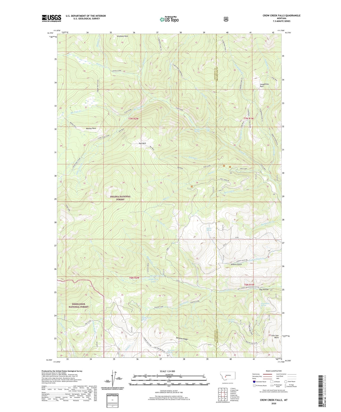
2020 topographic map quadrangle Crow Creek Falls in the state of Montana. Scale: 1:24000. Based on the newly updated USGS 7.5' US Topo map series, this map is in the following counties: Jefferson, Broadwater. The map contains contour data, water features, and other items you are used to seeing on USGS maps, but also has updated roads and other features. This is the next generation of topographic maps. Printed on high-quality waterproof paper with UV fade-resistant inks.
Quads adjacent to this one:
West: Elkhorn
Northwest: Clancy
North: Casey Peak
Northeast: Winston
East: Giant Hill
Southeast: Radersburg
South: Devils Fence
Southwest: Tacoma Park
Contains the following named places: Ballard Mine, Bear Gulch, Big Tizer Creek, Big Tizer Wildcat Mine, Blacker Creek, Bomar Spring, Bonanza Mine, Bonanza Ridge, Bonanza Spring, Boulaway Mine, Calahan Mine, Calahan/Pataloma Mine, Church Spring, Clear Creek, Crazy Creek, Crow Creek Falls, Dewey Creek, Eagle Creek, Elkhorn Mountains, Eureka Creek, Falls Creek, Gold Dust, Gold Dust Post Office, Golden Age Mine, Hall Creek, Hog Hollow, Hog Hollow Mine, Hog Hollow Spring, Little Tizer Creek, Little Tizer Wildcat Mine, Longfellow Creek, Longfellow Park, Manley Park, Moose Creek, NE NE Section 3 Mine, Pataloma Mine, Poe Park, Slim Sam Basin, South Fork Lakes, Spring Creek, Swamp Creek, Swamp Creek Spring, Teakettle Creek, Tizer Ranger Station, Two Sam Spring, Warner Creek, Wilson Creek