MyTopo
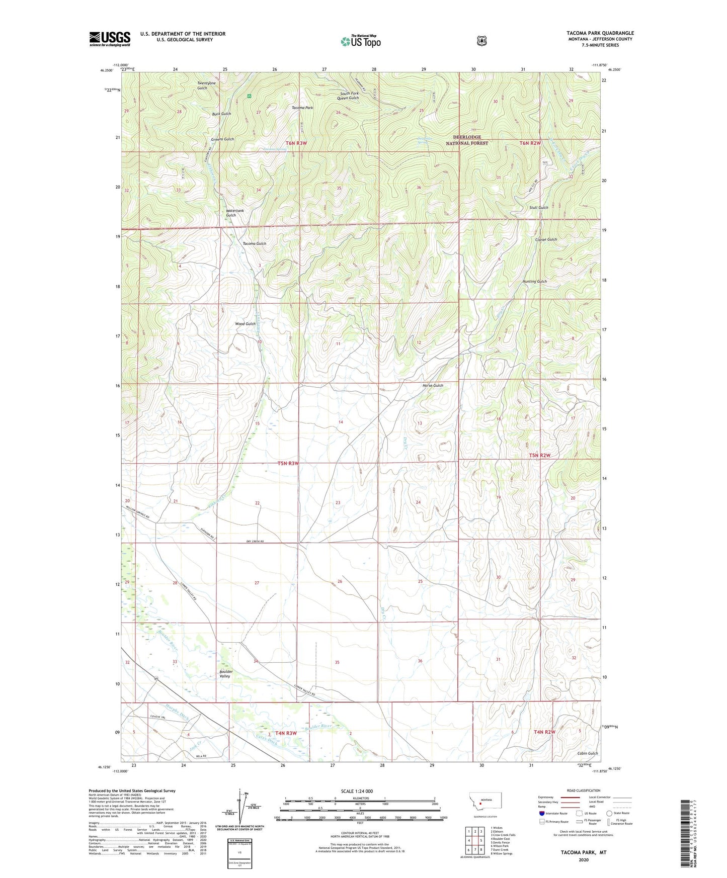
Tacoma Park Montana US Topo Map
Couldn't load pickup availability
Also explore the Tacoma Park Forest Service Topo of this same quad for updated USFS data
2024 topographic map quadrangle Tacoma Park in the state of Montana. Scale: 1:24000. Based on the newly updated USGS 7.5' US Topo map series, this map is in the following counties: Jefferson. The map contains contour data, water features, and other items you are used to seeing on USGS maps, but also has updated roads and other features. This is the next generation of topographic maps. Printed on high-quality waterproof paper with UV fade-resistant inks.
Quads adjacent to this one:
West: Boulder East
Northwest: Wickes
North: Elkhorn
Northeast: Crow Creek Falls
East: Devils Fence
Southeast: Willow Springs
South: Dunn Creek
Southwest: Wilson Park
This map covers the same area as the classic USGS quad with code o46111b8.
Contains the following named places: 04N03W01CCAD01 Well, 04N03W01CCAD02 Well, 05N03W21DACD01 Well, 05N03W22CAAA01 Well, 05N03W22DBBB01 Well, 05N03W34BACA01 Well, 05N03W34BBCB01 Well, 05N03W35CDCC01 Well, Blazing Place, Bob Mine, Buck Gulch, Carey-Twohy Ditch, Clarke Gulch, Deadman Spring, East Fork Dry Creek, Elkhorn Creek, Elkhorn Queen Mine, Finn, Finn Post Office, Finn School, Greens Gulch, Horse Gulch, Hunting Gulch, Jack Creek, Lazy T Ranch, Rex Mine, Stull Gulch, SW SW Section 24 Mine, Tacoma Gulch, Tacoma Park, Tacoma Spring, Trotter Post Office, Twentyone Gulch, Watertank Gulch, West Fork Dry Creek, Wood Gulch