MyTopo
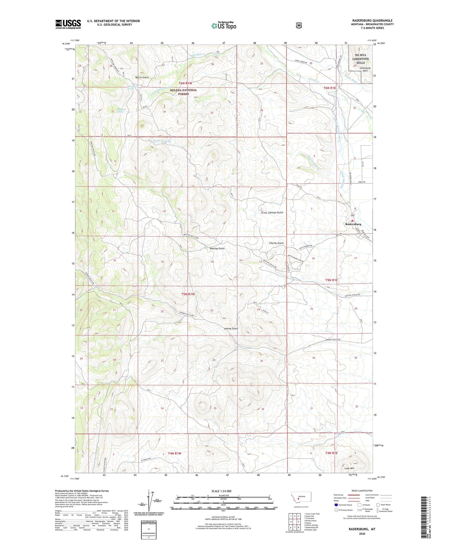
Radersburg Montana US Topo Map
Couldn't load pickup availability
Also explore the Radersburg Forest Service Topo of this same quad for updated USFS data
2024 topographic map quadrangle Radersburg in the state of Montana. Scale: 1:24000. Based on the newly updated USGS 7.5' US Topo map series, this map is in the following counties: Broadwater. The map contains contour data, water features, and other items you are used to seeing on USGS maps, but also has updated roads and other features. This is the next generation of topographic maps. Printed on high-quality waterproof paper with UV fade-resistant inks.
Quads adjacent to this one:
West: Devils Fence
Northwest: Crow Creek Falls
North: Giant Hill
Northeast: Townsend
East: Parker
Southeast: Plunket Lake
South: Radersburg SW
Southwest: Willow Springs
This map covers the same area as the classic USGS quad with code o46111b6.
Contains the following named places: 05N01E08BC__01 Well, 05N01E08BD__01 Well, 05N01E08CA__01 Well, 05N01E08CD__01 Well, 05N01E08CD__02 Well, 05N01E17AB__01 Well, 06N01E32DBBA01 Well, Beauty Mine, Black Friday Mines, Bonanza Mine, Dandy Mine, Dowdy Ditch, Hard Cash Mine, Hollings Ditch, Kahoka Mine, Keating Mine, Keating Mines, Keating Tailings, Keatingville, Keatingville Post Office, Lone Mountain, Monarch Mine, Nada Mine, NE NE Section 21 Mine, NE NW Section 33 Mine, NE SE Section 17 Mine, NE SW Section 4 Mine, Norris Gulch, North Home Mines, NW NW Section 14 Mine, NW SW Section 4 Mine, Ohio Mine, Ohio Mines, Piedmont Spring, Quartzite Mine, Radersburg, Radersburg Census Designated Place, Radersburg Post Office, Radersburg School, Radersburg Volunteer Fire Department, Ralls Mines, Rattlesnake Creek, Ruby Mine, San Anita Mine, SE SW Section 33 Mine, South Fork Slim Sam Creek, SW SE Section 21 Mine, SW SE Section 9 Mine, Swede Ditch, Swede-Hollings Ditch, Townsend West Division, Uncle Johnnys Gulch, White Rock Spring