MyTopo
Cutoff Mountain Montana US Topo Map
Couldn't load pickup availability
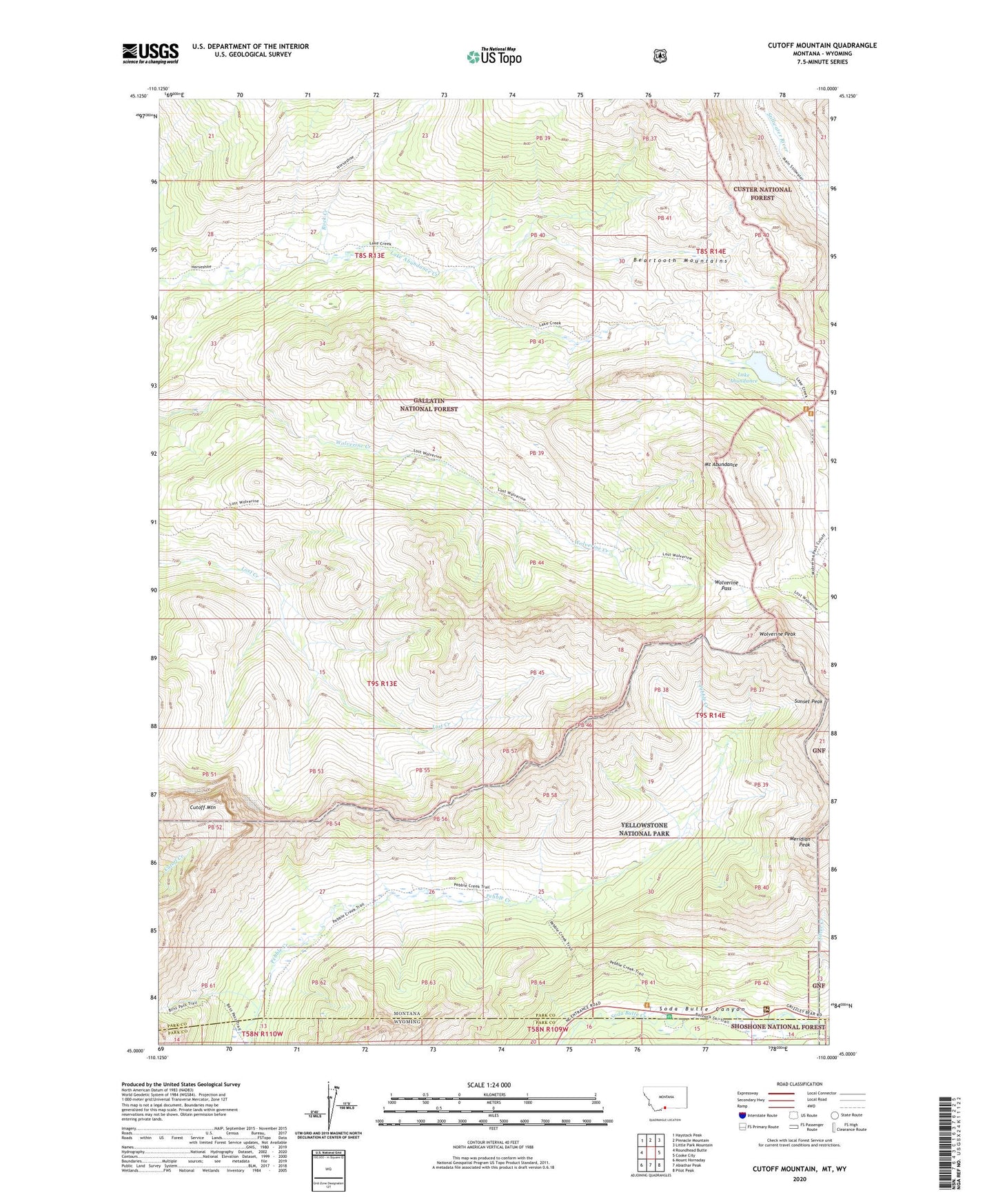
2020 topographic map quadrangle Cutoff Mountain in the state of Montana. Scale: 1:24000. Based on the newly updated USGS 7.5' US Topo map series, this map is in the following counties: Park. The map contains contour data, water features, and other items you are used to seeing on USGS maps, but also has updated roads and other features. This is the next generation of topographic maps. Printed on high-quality waterproof paper with UV fade-resistant inks.
Quads adjacent to this one:
West: Roundhead Butte
Northwest: Haystack Peak
North: Pinnacle Mountain
Northeast: Little Park Mountain
East: Cooke City
Southeast: Pilot Peak
South: Abiathar Peak
Southwest: Mount Hornaday
Contains the following named places: Cooke Ranger Station, Cutoff Mountain, Lake Abundance, Meridian Peak, Mount Abundance, Northeast Entrance, Rock Creek, Sunset Peak, Wolverine Pass, Wolverine Peak, ZIP Code: 59020