MyTopo
Pinnacle Mountain Montana US Topo Map
Couldn't load pickup availability
Also explore the Pinnacle Mountain Forest Service Topo of this same quad for updated USFS data
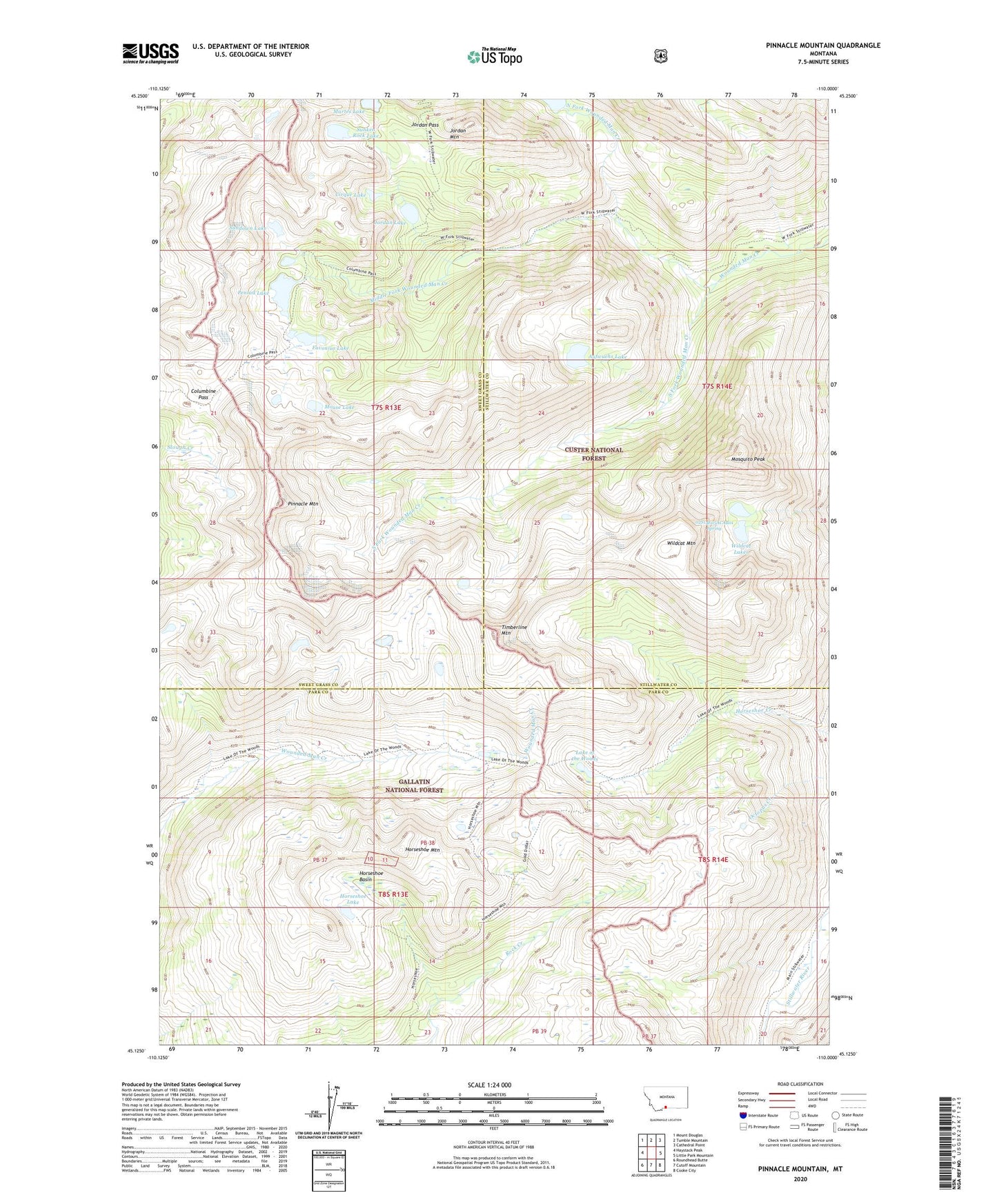
2024 topographic map quadrangle Pinnacle Mountain in the state of Montana. Scale: 1:24000. Based on the newly updated USGS 7.5' US Topo map series, this map is in the following counties: Park, Stillwater, Sweet Grass. The map contains contour data, water features, and other items you are used to seeing on USGS maps, but also has updated roads and other features. This is the next generation of topographic maps. Printed on high-quality waterproof paper with UV fade-resistant inks.
Quads adjacent to this one:
West: Haystack Peak
Northwest: Mount Douglas
North: Tumble Mountain
Northeast: Cathedral Point
East: Little Park Mountain
Southeast: Cooke City
South: Cutoff Mountain
Southwest: Roundhead Butte
This map covers the same area as the classic USGS quad with code o45110b1.
Contains the following named places: 02S14E05ACAB01 Spring, Absaroka-Beartooth Wilderness, Aufwuchs Lake, Cirque Lake, Columbine Pass, Favonius Lake, Horseshoe Basin, Horseshoe Lake, Horseshoe Mountain, Horseshoe Mountain Adit Mine, Horseshoe Mountain Shaft, Jordan Lake, Jordan Mountain, Jordan Pass, Lake of the Woods, Martes Lake, Middle Fork Wounded Man Creek, Mosquito Peak, Mouse Lake, North Fork Wounded Man Creek, Pentad Lake, Pinnacle Mountain, South Fork Wounded Man Creek, Sundown Lake, Sunken Rock Lake, Timberline Mountain, Wildcat Lakes, Wildcat Mountain