MyTopo
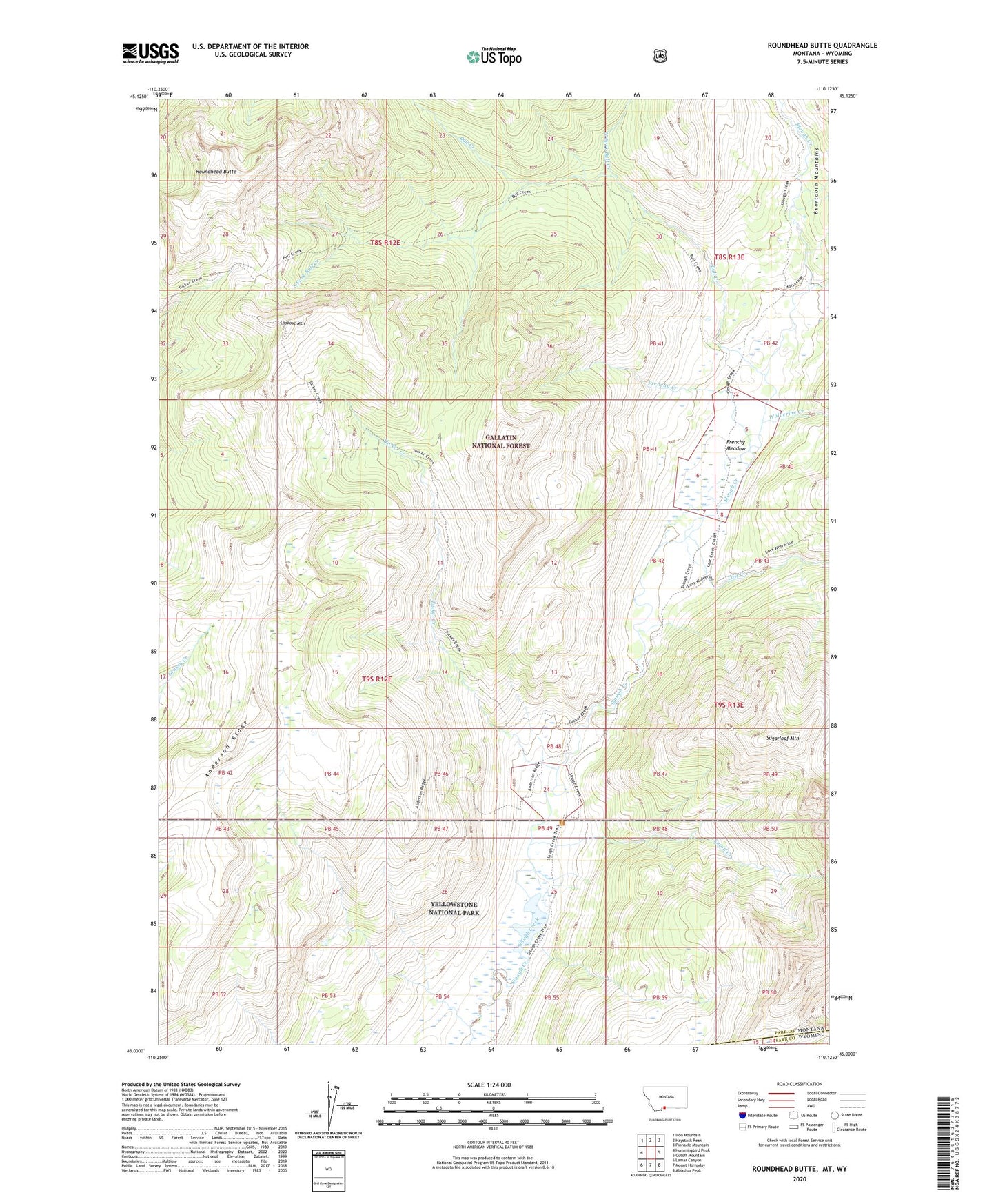
Roundhead Butte Montana US Topo Map
Couldn't load pickup availability
Also explore the Roundhead Butte Forest Service Topo of this same quad for updated USFS data
2024 topographic map quadrangle Roundhead Butte in the state of Montana. Scale: 1:24000. Based on the newly updated USGS 7.5' US Topo map series, this map is in the following counties: Park. The map contains contour data, water features, and other items you are used to seeing on USGS maps, but also has updated roads and other features. This is the next generation of topographic maps. Printed on high-quality waterproof paper with UV fade-resistant inks.
Quads adjacent to this one:
West: Hummingbird Peak
Northwest: Iron Mountain
North: Haystack Peak
Northeast: Pinnacle Mountain
East: Cutoff Mountain
Southeast: Abiathar Peak
South: Mount Hornaday
Southwest: Lamar Canyon
Contains the following named places: Anderson Ridge, Bull Creek, Cutoff Creek, Frenchy Creek, Frenchy Meadow, Lake Abundance Creek, Lookout Mountain, Lost Creek, North Fork Bull Creek, Roundhead Butte, Silver Tip Ranch, Slough Creek Guard Station, South Fork Bull Creek, Sugarloaf Mountain, Tucker Creek, Wolverine Creek