MyTopo
Daleview Montana US Topo Map
Couldn't load pickup availability
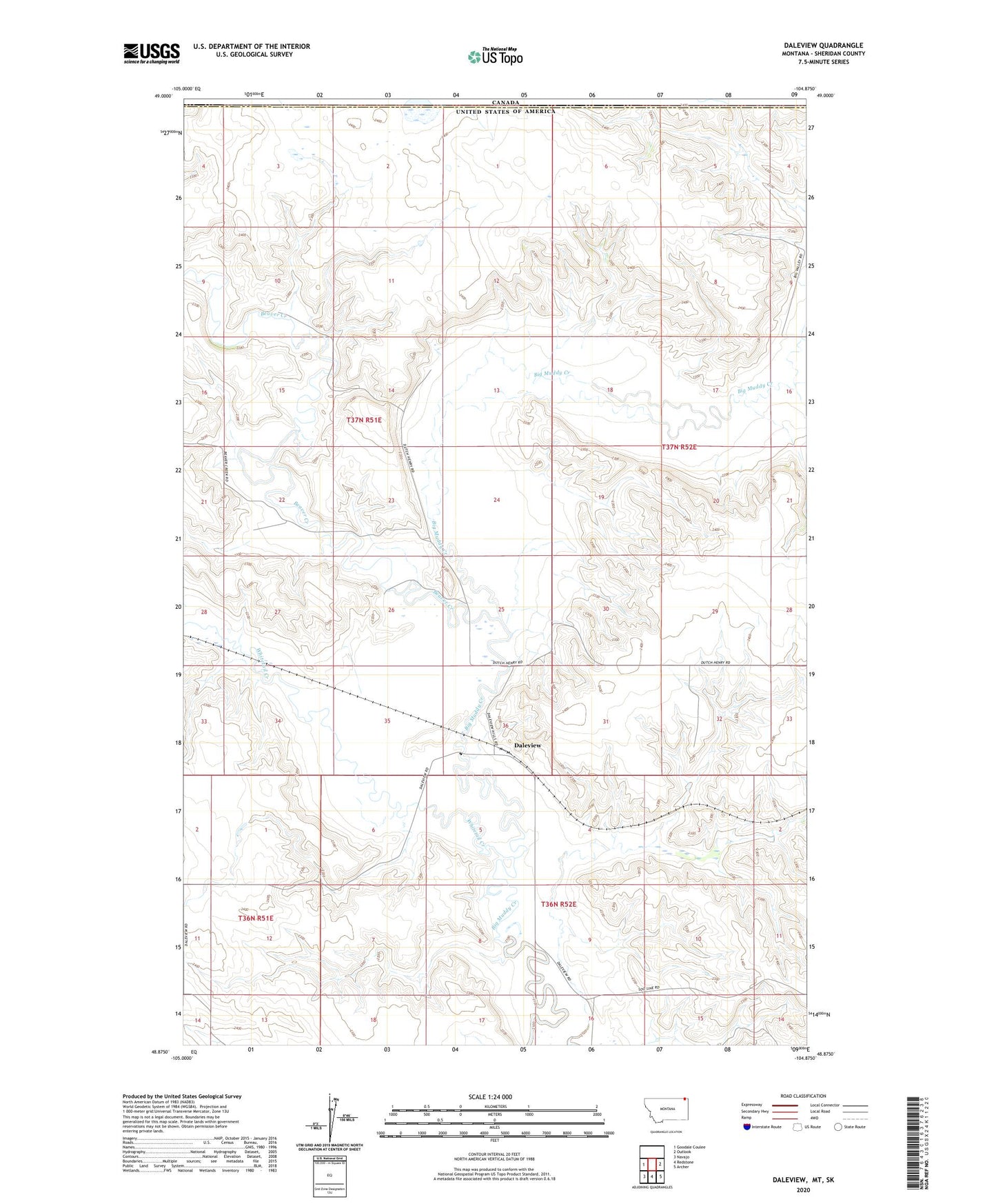
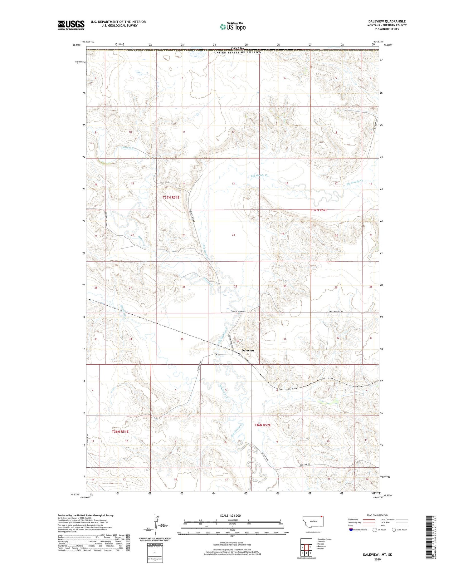
2020 topographic map quadrangle Daleview in the state of Montana. Scale: 1:24000. Based on the newly updated USGS 7.5' US Topo map series, this map is in the following counties: Sheridan. The map contains contour data, water features, and other items you are used to seeing on USGS maps, but also has updated roads and other features. This is the next generation of topographic maps. Printed on high-quality waterproof paper with UV fade-resistant inks.
Quads adjacent to this one:
West: Goodale Coulee
East: Outlook
Southeast: Archer
South: Redstone
Southwest: Navajo
Contains the following named places: 36N52E11CD__01 Well, Beaver Creek, Beaver Creek School, Daleview, Daleview Post Office, Daleview School, Desonia School, Methodist Free Church of Daleview, Robinson School, Whitetail Creek