MyTopo
Redstone Montana US Topo Map
Couldn't load pickup availability
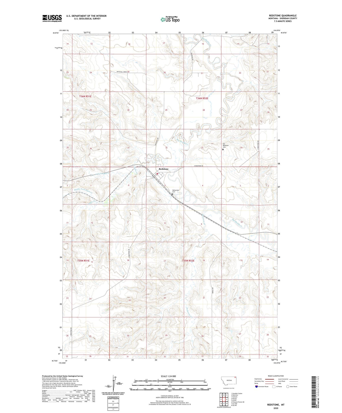
2024 topographic map quadrangle Redstone in the state of Montana. Scale: 1:24000. Based on the newly updated USGS 7.5' US Topo map series, this map is in the following counties: Sheridan. The map contains contour data, water features, and other items you are used to seeing on USGS maps, but also has updated roads and other features. This is the next generation of topographic maps. Printed on high-quality waterproof paper with UV fade-resistant inks.
Quads adjacent to this one:
West: Navajo
Northwest: Goodale Coulee
North: Daleview
Northeast: Outlook
East: Archer
Southeast: Soo NE
South: Soo NW
Southwest: Pleasant Prairie NE
This map covers the same area as the classic USGS quad with code o48104g8.
Contains the following named places: 35N52E05BBD_01 Well, 35N52E07CD__01 Well, 35N52E15CADC01 Well, 35N52E18CD__01 Well, 59257, Big Muddy Golf Club, Eagle Creek, Middle Fork Eagle Creek, Miller Dam, Ness School, North Fork Eagle Creek, Old Redstone Cemetery, Primrose Dam, Redstone, Redstone Census Designated Place, Redstone Creek, Redstone Grain Company, Redstone Methodist Church, Redstone Post Office, Redstone Rural Fire District, Redstone School, Valleyview Cemetery