MyTopo
Edwards Montana US Topo Map
Couldn't load pickup availability
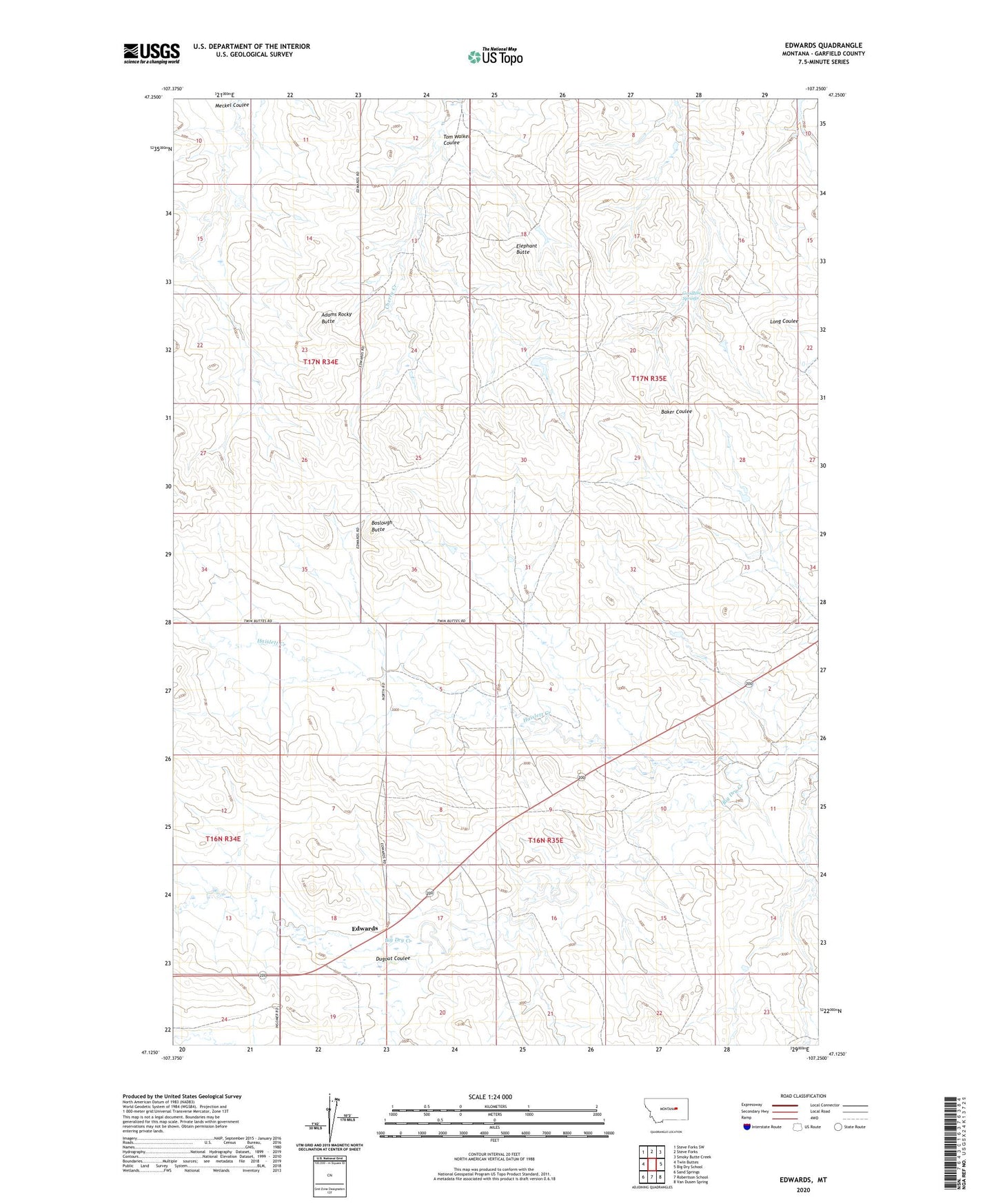
2024 topographic map quadrangle Edwards in the state of Montana. Scale: 1:24000. Based on the newly updated USGS 7.5' US Topo map series, this map is in the following counties: Garfield. The map contains contour data, water features, and other items you are used to seeing on USGS maps, but also has updated roads and other features. This is the next generation of topographic maps. Printed on high-quality waterproof paper with UV fade-resistant inks.
Quads adjacent to this one:
West: Twin Buttes
Northwest: Steve Forks SW
North: Steve Forks
Northeast: Smoky Butte Creek
East: Big Dry School
Southeast: Van Dusen Spring
South: Robertson School
Southwest: Sand Springs
This map covers the same area as the classic USGS quad with code o47107b3.
Contains the following named places: Adams Rocky Butte, Anad, Anad Post Office, Anad School, Boslough Butte, Cherry Number 1 Dam, Dugout Coulee, Edwards, Edwards Post Office, Edwards School, Elephant Butte, Goodhue Springs, Haislett Creek, Tom Walker Coulee