MyTopo
Elk Park Pass Montana US Topo Map
Couldn't load pickup availability
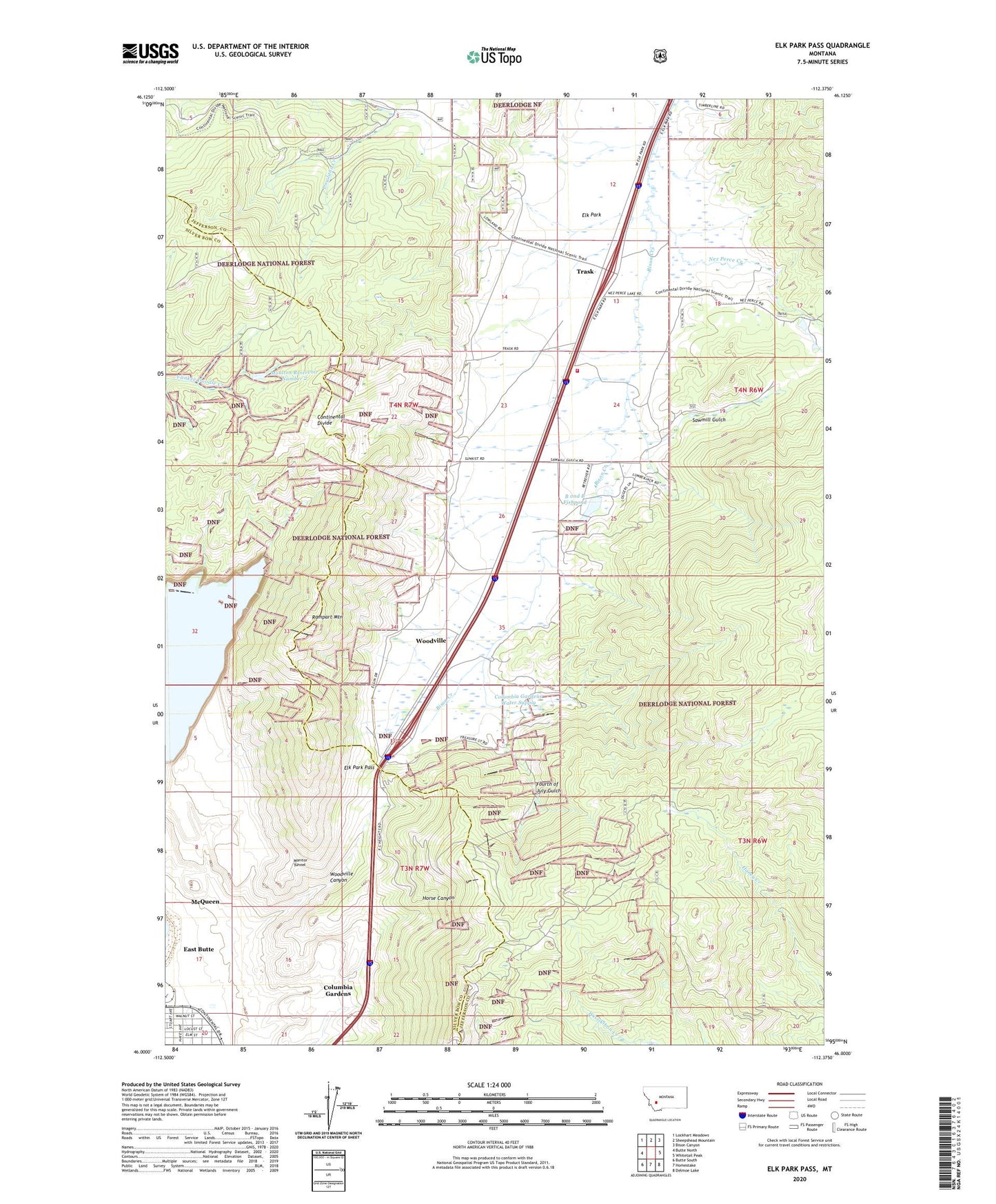
2020 topographic map quadrangle Elk Park Pass in the state of Montana. Scale: 1:24000. Based on the newly updated USGS 7.5' US Topo map series, this map is in the following counties: Jefferson, Silver Bow. The map contains contour data, water features, and other items you are used to seeing on USGS maps, but also has updated roads and other features. This is the next generation of topographic maps. Printed on high-quality waterproof paper with UV fade-resistant inks.
Quads adjacent to this one:
West: Butte North
Northwest: Lockhart Meadows
North: Sheepshead Mountain
Northeast: Bison Canyon
East: Whitetail Peak
Southeast: Delmoe Lake
South: Homestake
Southwest: Butte South
Contains the following named places: B and B Fish Pond Dam, B and B Fishpond, Bison Retriever Dam, Columbia Gardens, Columbia Gardens Water Supply, East Butte, Elk Park, Elk Park Fire Hall, Elk Park Pass, Elk Park Rural Fire District, Fourth of July Gulch, Horse Canyon, KOPR-FM (Butte), KQUY-FM (Butte), KTVM-TV (Butte), KXLF-TV (Butte), Last Chance Mine, Marie, Mary Emmee/Clinton Mine, McQueen, Monitor Tunnel, Montana Union Transfer, Moulton Reservoir Number 2, Moulton Reservoir Number 2 Dam, Mountain Junction, NE SW Section 18 Mine, Nez Perce Creek, NW NW Section 18 Mine, NW NW Section 19 Mine, Paraiso/Stumbling Bl Mine, Prospector/Brodie Number 2 Mine, Rampart Mountain, Rex/Vindicator Mine, Sawmill Gulch, SE SW Section 14 Mine, SE SW Section 3 Mine, Seventh Day Adventist Church, Silver Bow Park, Trask, Woodville, Woodville Canyon, Woodville Post Office, ZIP Code: 59701