MyTopo
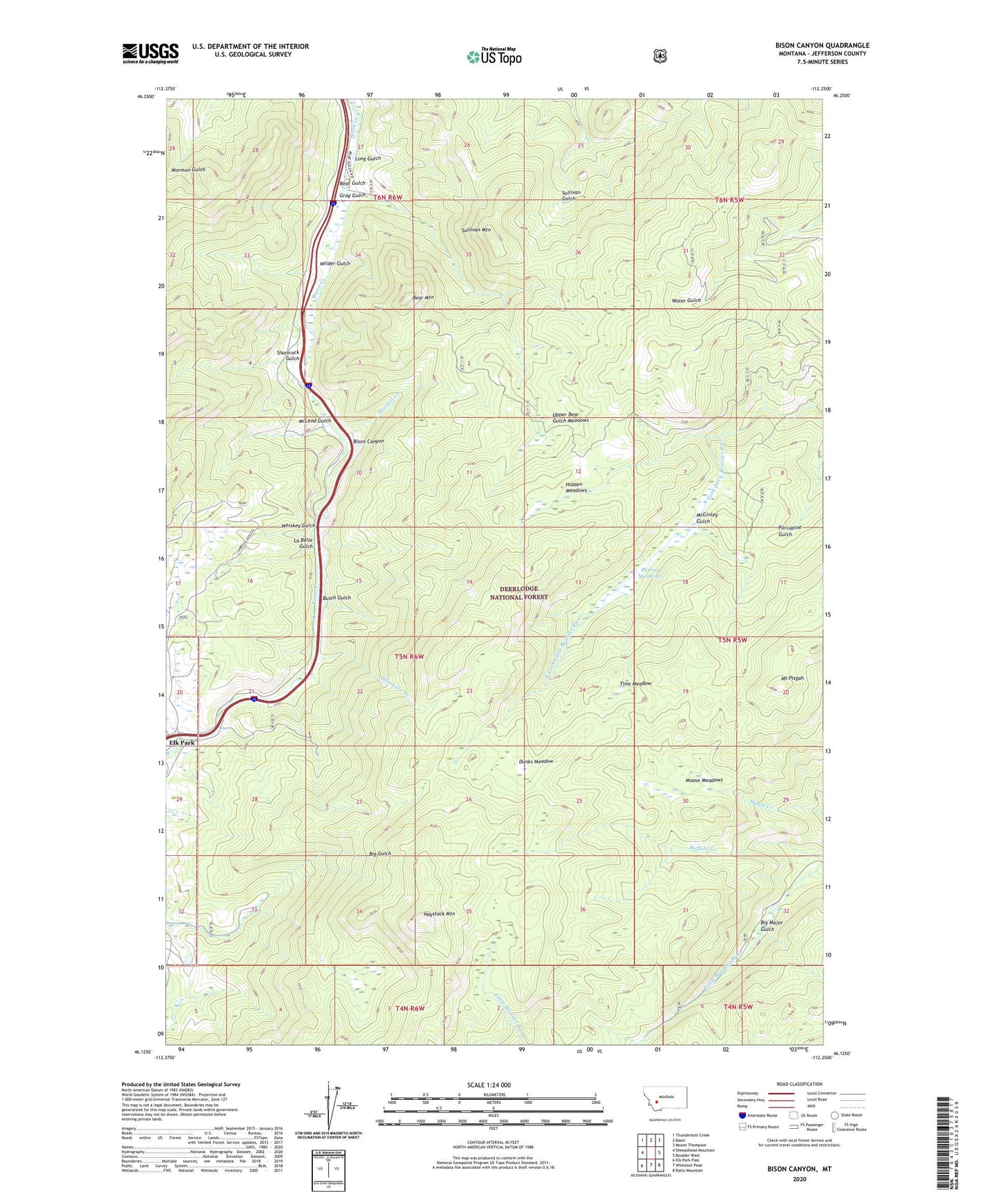
Bison Canyon Montana US Topo Map
Couldn't load pickup availability
Also explore the Bison Canyon Forest Service Topo of this same quad for updated USFS data
2024 topographic map quadrangle Bison Canyon in the state of Montana. Scale: 1:24000. Based on the newly updated USGS 7.5' US Topo map series, this map is in the following counties: Jefferson. The map contains contour data, water features, and other items you are used to seeing on USGS maps, but also has updated roads and other features. This is the next generation of topographic maps. Printed on high-quality waterproof paper with UV fade-resistant inks.
Quads adjacent to this one:
West: Sheepshead Mountain
Northwest: Thunderbolt Creek
North: Basin
Northeast: Mount Thompson
East: Boulder West
Southeast: Ratio Mountain
South: Whitetail Peak
Southwest: Elk Park Pass
This map covers the same area as the classic USGS quad with code o46112b3.
Contains the following named places: Alport Mine, Bear Gulch, Bear Mountain, Berrys Meadows, Big Major Gulch, Bison Canyon, Bison Creek Campground, Busch Gulch, Dunks Meadow, Elk Park, Elk Park Campground, Elk Park Post Office, Eureka Mine, Gray Gulch, Haystack Mountain, Hidden Meadows, Homesite Creek, La Belle Gulch, Long Gulch, McGinley Gulch, McLeod Gulch, Moose Meadows, Mount Pisgah, Mount Pisgah Mine, Porphyry Mine, Sawmill Creek, Shamrock Campground, Shamrock Gulch, Shiels and Ironsides Mine, Silversmith Mine, Sullivan Mountain, SW NW Section 6 Mine, SW SE Section 21 Mine, Tims Meadow, Upper Bear Gulch Meadows, Whiskey Gulch, Wilder, Wilder Gulch