MyTopo
Elkhorn Montana US Topo Map
Couldn't load pickup availability
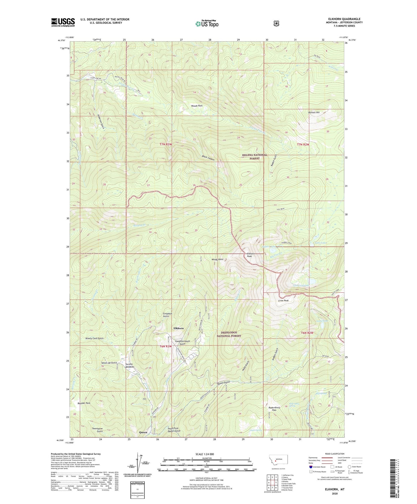
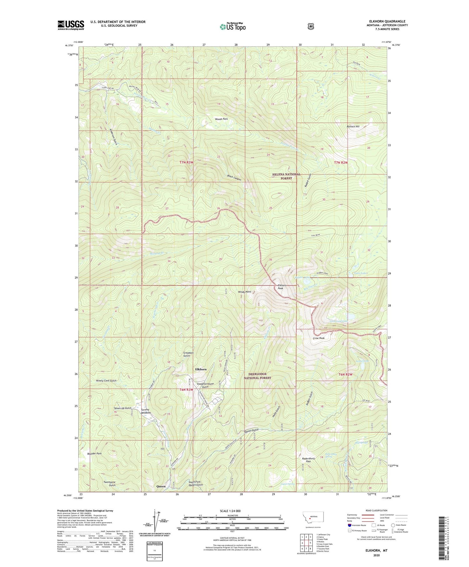
2020 topographic map quadrangle Elkhorn in the state of Montana. Scale: 1:24000. Based on the newly updated USGS 7.5' US Topo map series, this map is in the following counties: Jefferson. The map contains contour data, water features, and other items you are used to seeing on USGS maps, but also has updated roads and other features. This is the next generation of topographic maps. Printed on high-quality waterproof paper with UV fade-resistant inks.
Quads adjacent to this one:
West: Wickes
Northwest: Jefferson City
North: Clancy
Northeast: Casey Peak
East: Crow Creek Falls
Southeast: Devils Fence
South: Tacoma Park
Southwest: Boulder East
Contains the following named places: Anderson Gulch, Black Canyon, Boulaway Mine, Boulder Park, Bullock Hill, C and D Mine, Carmody Mine, Crow Peak, DuBois Gulch, Dunstone/Klondyke Mine, East Butte Mine, Elkhorn, Elkhorn Census Designated Place, Elkhorn Peak, Elkhorn Picnic Area, Elkhorn Post Office, Elkhorn Skyline Mine, Elkhorn State Park, Glenwood Lake, Golden Moss Mine, Greyback Gulch, Hardcash Mine, Heggen Mine, Hidden Lake, Hobo Gulch, Iron Mine, James R Keene Mine, King of Sweden Mine, Leslie Lake, Louise Mine, Lupien Spring, Luxanburgh Mine, Moreau Mine, Mud Springs, Ninety Cent Gulch, Queen, Queen Gulch, Queen Post Office, Rabbit Gulch, Radersburg Pass, Rube Sobey Spring, Ruddville, SE NE Section 2 Mine, SE SW Section 1 Mine, Seven-Up Gulch, Seven-Up Gulch Mine, Skyline Mine, Slaughterhouse Gulch, Sourdough, Sourdough Creek, Sourdough Mine, South Fork Queen Gulch, Spring Creek, Tizer Lakes, Tizer Lakes Fishing Access Site, Turnley Creek, Turnley Meadows, Union Mine, Weimer Creek, Windy Point, Woods Park, ZIP Code: 59638