MyTopo
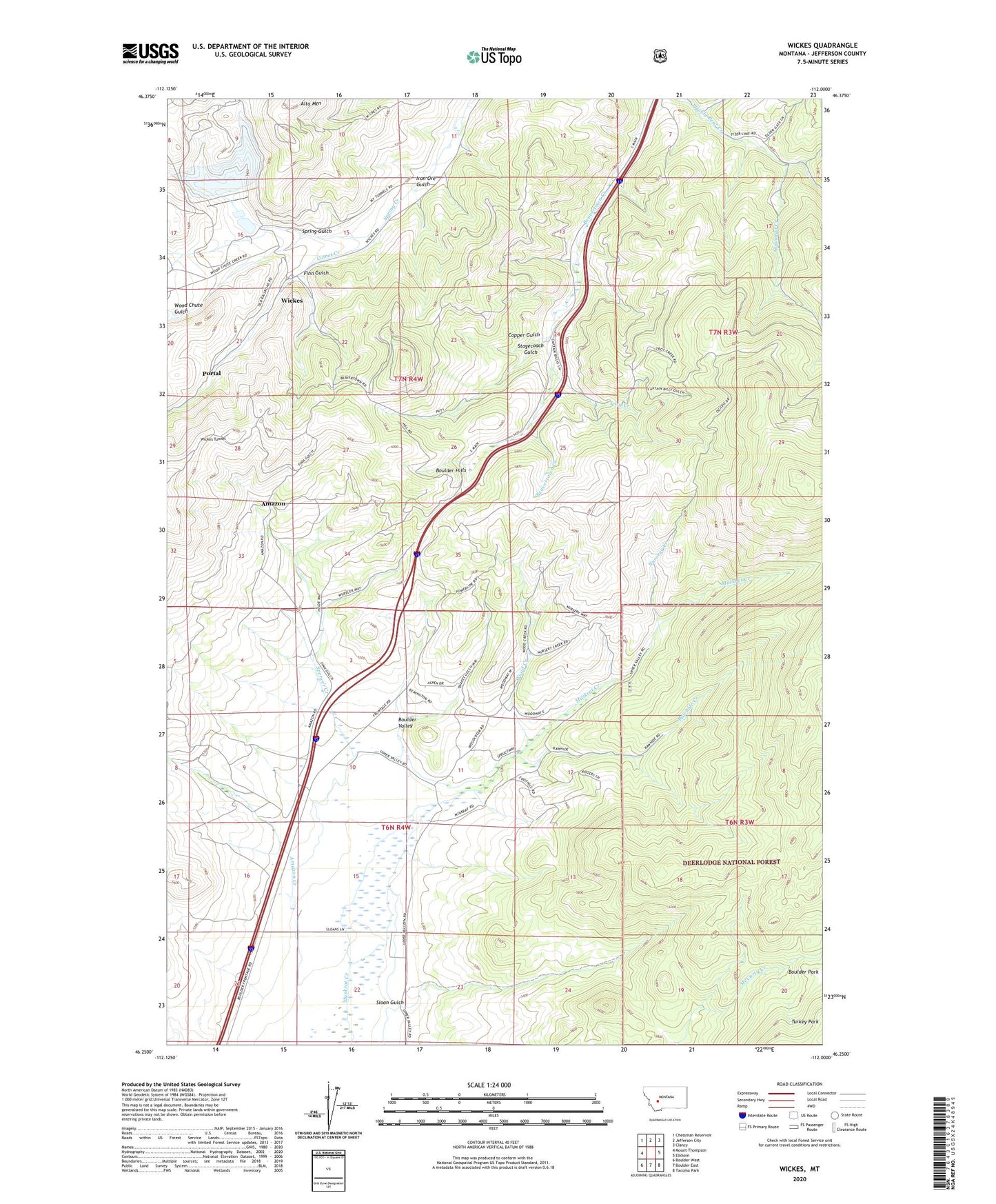
Wickes Montana US Topo Map
Couldn't load pickup availability
Also explore the Wickes Forest Service Topo of this same quad for updated USFS data
2024 topographic map quadrangle Wickes in the state of Montana. Scale: 1:24000. Based on the newly updated USGS 7.5' US Topo map series, this map is in the following counties: Jefferson. The map contains contour data, water features, and other items you are used to seeing on USGS maps, but also has updated roads and other features. This is the next generation of topographic maps. Printed on high-quality waterproof paper with UV fade-resistant inks.
Quads adjacent to this one:
West: Mount Thompson
Northwest: Chessman Reservoir
North: Jefferson City
Northeast: Clancy
East: Elkhorn
Southeast: Tacoma Park
South: Boulder East
Southwest: Boulder West
This map covers the same area as the classic USGS quad with code o46112c1.
Contains the following named places: 06N04W14BCBA01 Well, 06N04W14CBB_01 Well, 06N04W14CBB_02 Well, 06N04W15DCC_01 Well, 07N04W09DBDB01 Well, 07N04W11CDCD01 Well, 07N04W14BBCC01 Well, 07N04W14BBCD01 Well, 07N04W16ACCA01 Well, 07N04W16BBAA01 Well, 07N04W16CDBB01 Well, 07N04W16DBAA01 Well, 07N04W16DBBA01 Well, 07N04W16DBDA01 Well, 07N04W16DCAA01 Well, Alta Mine, Alta Mines, Alta Mountain, Amazon, Amazon Creek, Amazon Post Office, Beavertown, Boulder Division, Boulder Hills, Boulder Junction, Bunker Hill Mine, Comet Creek, Copper Gulch, Copper Gulch Mine, Eureka Mine, Finn Gulch, Golconda Creek, Hodson, Iron Ore Gulch, Kyle, Lake Mine, NE NE Section 29 Mine, NE NE Section 3 Mine, Nursery Creek, Portal, Rawhide Creek, Rieder, SE NW Section 22 Mine, Sloan Gulch, Sloan Ranch, Spencer Creek, Spring Gulch, Stagecoach Gulch, Summit, SW SW Section 22 Mine, Tamarack Junior Mine, Thistle, Troy Creek, Turkey Park, Wickes, Wickes Post Office, Wickes Tailings, Wickes Tunnel, Wood Chute Gulch, Wood Creek, Zenith