MyTopo
Fallon SW Montana US Topo Map
Couldn't load pickup availability
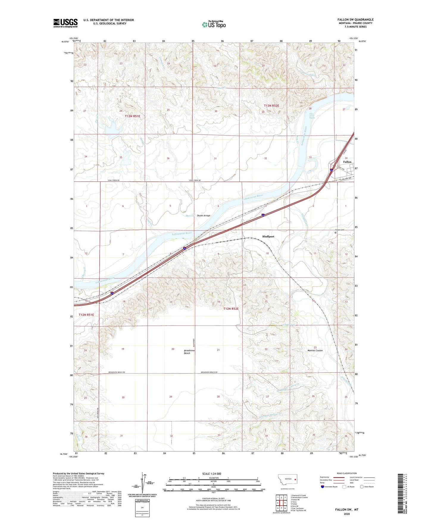
2024 topographic map quadrangle Fallon SW in the state of Montana. Scale: 1:24000. Based on the newly updated USGS 7.5' US Topo map series, this map is in the following counties: Prairie. The map contains contour data, water features, and other items you are used to seeing on USGS maps, but also has updated roads and other features. This is the next generation of topographic maps. Printed on high-quality waterproof paper with UV fade-resistant inks.
Quads adjacent to this one:
West: Terry
Northwest: Diamond G Creek
North: Hendrickson Coulee
Northeast: Fallon NE
East: Fallon
Southeast: Flat Top Butte NE
South: Flat Top Butte
Southwest: Zero NE
This map covers the same area as the classic USGS quad with code o46105g2.
Contains the following named places: 12N51E12CDAD01 Well, 12N51E13DB__01 Well, 12N52E04BBBB01 Well, 12N52E06BAAA01 Well, 12N52E18CB__01 Well, 12N52E23DBAD01 Well, 12N52E26BB__01 Well, 12N52E26BCAB01 Well, 13N51E34AADA01 Well, 13N52E29BDBC01 Well, 13N52E29CADB01 Well, 13N52E30CBCA01 Well, 13N52E32ADAA01 Well, 13N52E33AC__01 Well, 13N52E34CDBB01 Well, Bluffport, Brights Valley Creek, Broadview Bench, Broadview School, Cameron Creek, Cato, Cherry Creek, Coal Creek, Coal Creek Dam, Coal Creek Drop Dam, Coal Creek Reservoir, Cottonwood Creek, Deer Creek, Fallon Cemetery, Fallon Census Designated Place, Haley School, Johnson Creek, Mamies Coulee, Newman Hollow Creek, O'Fallon Creek, Pine Creek, Resettlement FSA Number 4 Dam, Skunk Arroyo, White Island Rapids