MyTopo
Felix Peak Montana US Topo Map
Couldn't load pickup availability
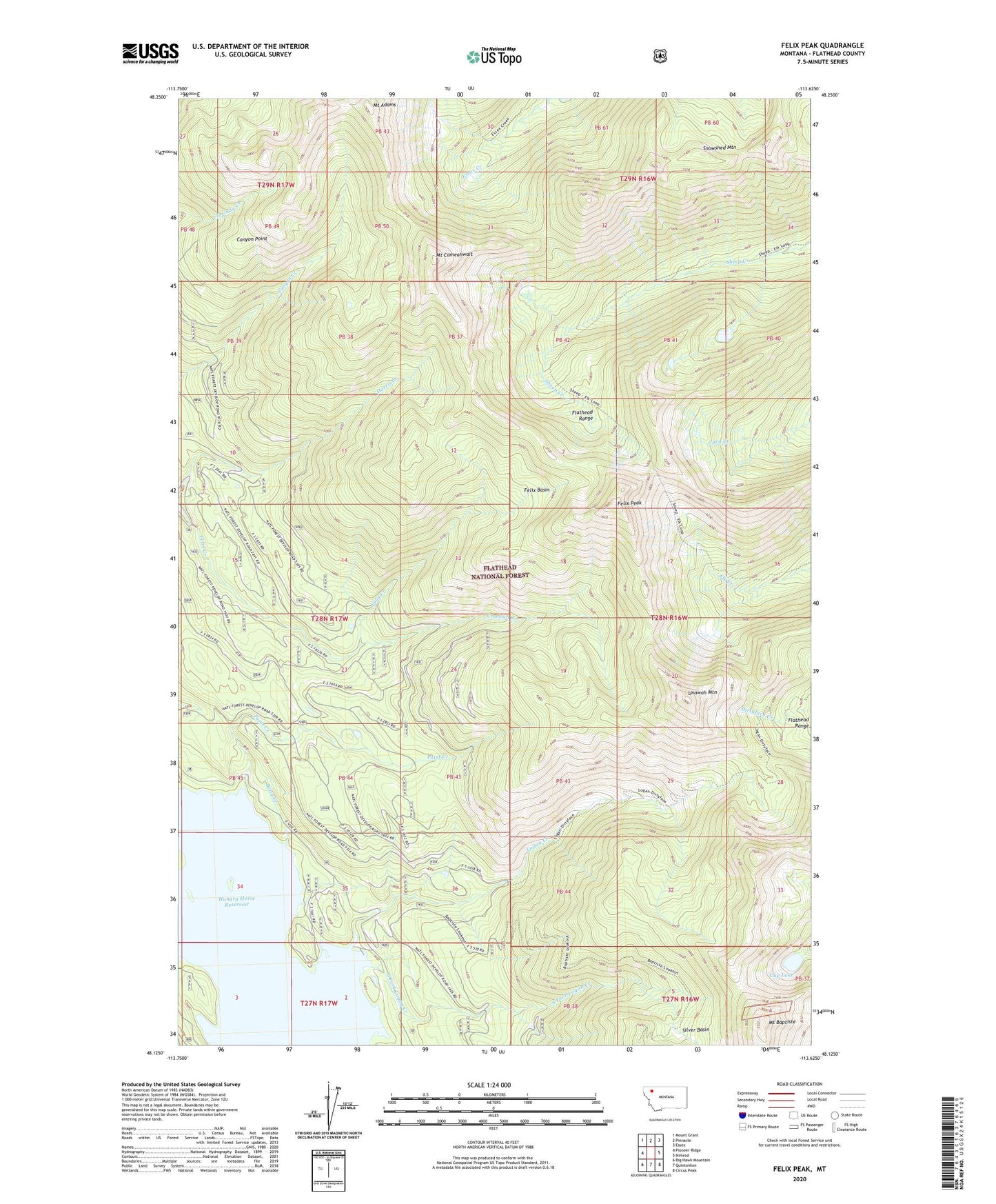
2020 topographic map quadrangle Felix Peak in the state of Montana. Scale: 1:24000. Based on the newly updated USGS 7.5' US Topo map series, this map is in the following counties: Flathead. The map contains contour data, water features, and other items you are used to seeing on USGS maps, but also has updated roads and other features. This is the next generation of topographic maps. Printed on high-quality waterproof paper with UV fade-resistant inks.
Quads adjacent to this one:
West: Pioneer Ridge
Northwest: Mount Grant
North: Pinnacle
Northeast: Essex
East: Nimrod
Southeast: Circus Peak
South: Quintonkon
Southwest: Big Hawk Mountain
Contains the following named places: Baptiste Lookout, Baptiste Lookout Trail, Betty Creek, Betty Creek Ranger Station, Canyon Lookout, Canyon Point, Cup Lake, Felix Basin, Felix Basin Trail, Felix Creek, Felix Mine, Felix Peak, Harris Creek, Harris Ridge Trail, Logan Creek, Mount Adams, Mount Baptiste, Mount Cameahwait, Murray Canyon Trail, Paint Creek, Paint Creek Trail, Sheep Creek Trail, Silver Basin, Silver Basin Mine, Snowshed Mountain, South Fork Logan Creek, Unawah Creek, Unawah Mountain