MyTopo
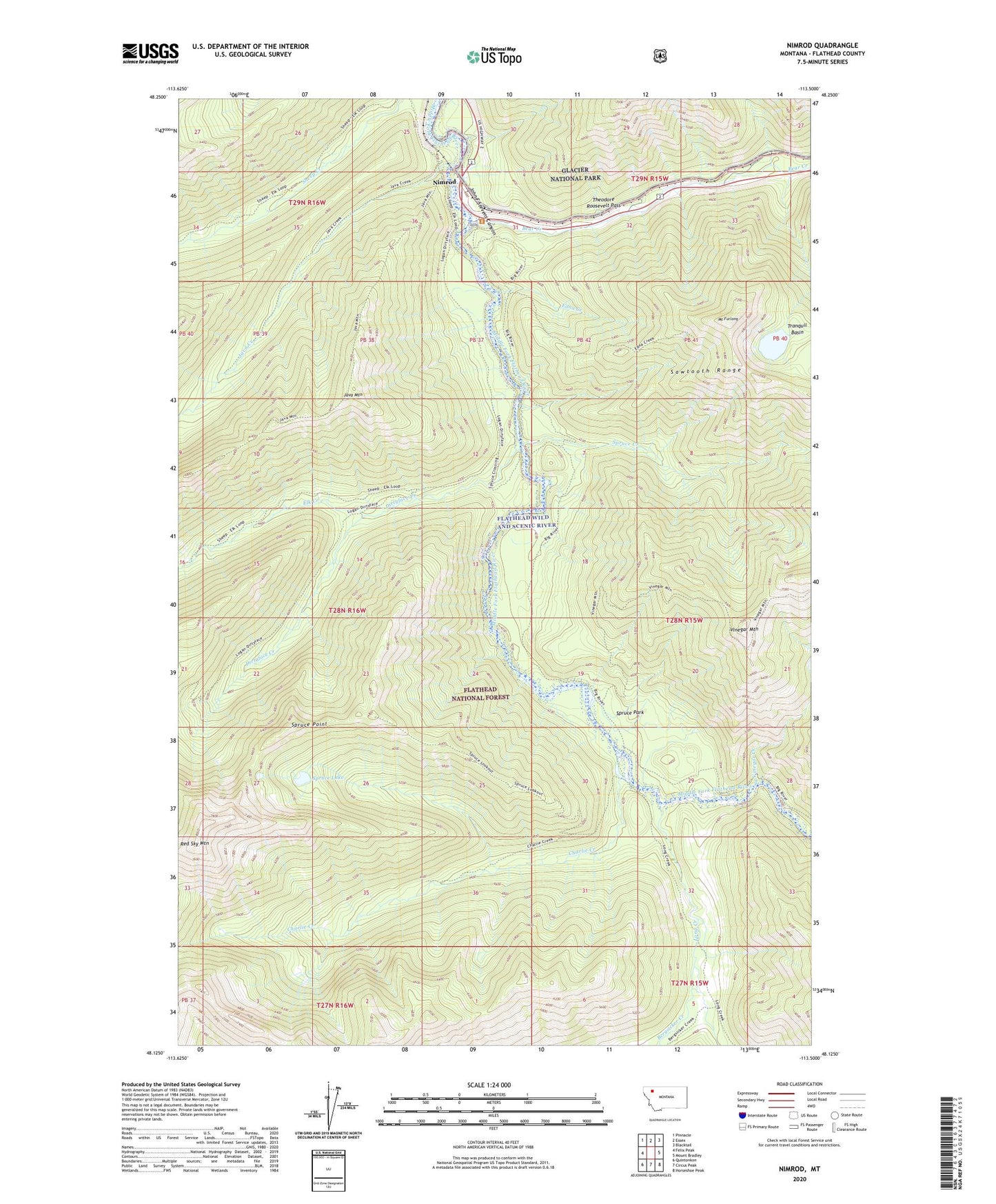
Nimrod Montana US Topo Map
Couldn't load pickup availability
Also explore the Nimrod Forest Service Topo of this same quad for updated USFS data
2024 topographic map quadrangle Nimrod in the state of Montana. Scale: 1:24000. Based on the newly updated USGS 7.5' US Topo map series, this map is in the following counties: Flathead. The map contains contour data, water features, and other items you are used to seeing on USGS maps, but also has updated roads and other features. This is the next generation of topographic maps. Printed on high-quality waterproof paper with UV fade-resistant inks.
Quads adjacent to this one:
West: Felix Peak
Northwest: Pinnacle
North: Essex
Northeast: Blacktail
East: Mount Bradley
Southeast: Horseshoe Peak
South: Circus Peak
Southwest: Quintonkon
This map covers the same area as the classic USGS quad with code o48113b5.
Contains the following named places: Bear Creek, Bergsicker Creek, Charlie Creek, Dirtyface Creek, Dirtyface-Logan Creek Trail, Edna Creek, Edna Creek Trail, Elk Creek, Java, Java Creek, Java Mountain, Java Ranger Station, Long Creek, Mount Furlong, Nimrod, Nimrod Mine, Red Sky Mountain, Spruce Creek, Spruce Lake, Spruce Lookout, Spruce Park, Spruce Park Forest Service Facility, Spruce Point, Summit Rest Area, Tranquil Basin, Vinegar Creek, Vinegar Mountain