MyTopo
Flat Creek School Montana US Topo Map
Couldn't load pickup availability
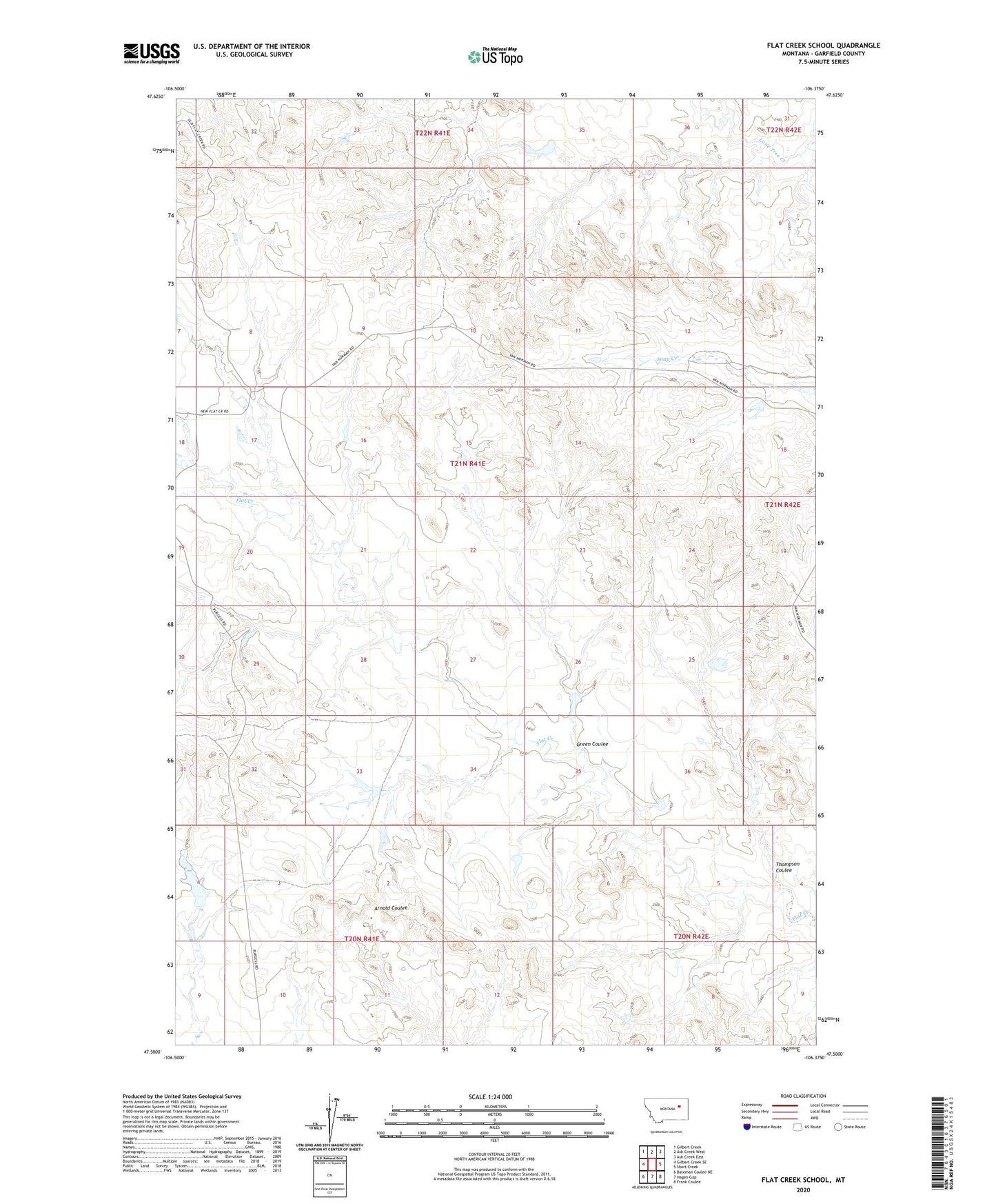
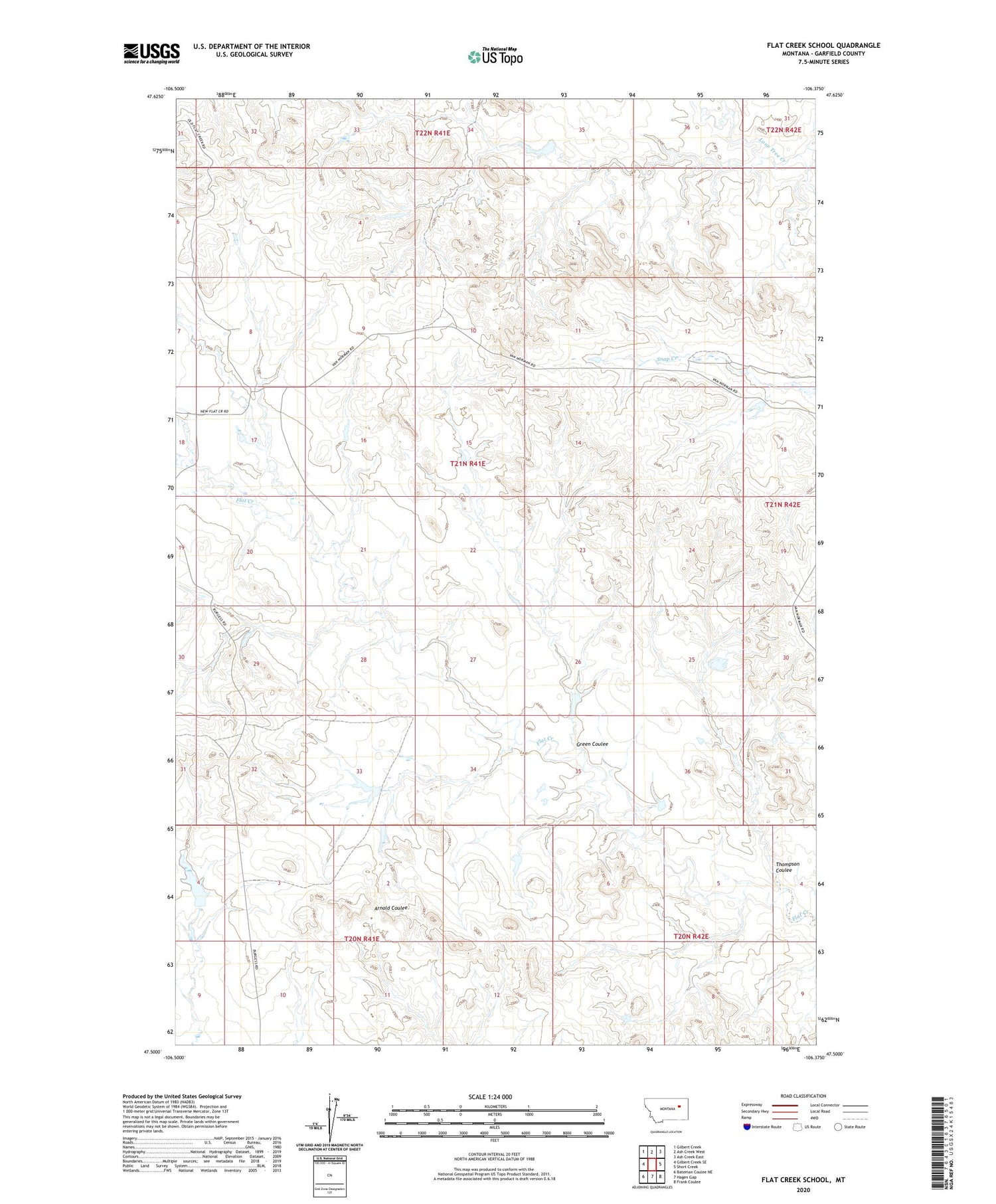
2020 topographic map quadrangle Flat Creek School in the state of Montana. Scale: 1:24000. Based on the newly updated USGS 7.5' US Topo map series, this map is in the following counties: Garfield. The map contains contour data, water features, and other items you are used to seeing on USGS maps, but also has updated roads and other features. This is the next generation of topographic maps. Printed on high-quality waterproof paper with UV fade-resistant inks.
Quads adjacent to this one:
West: Gilbert Creek SE
Northwest: Gilbert Creek
North: Ash Creek West
Northeast: Ash Creek East
East: Short Creek
Southeast: Frank Coulee
South: Hagen Gap
Southwest: Bateman Coulee NE
Contains the following named places: 21N41E08B___01 Well, 21N41E08D___01 Well, 21N41E11CCCB01 Well, 21N41E12C___01 Well, 21N41E12C___02 Well, 21N42E18BA__01 Well, Burgess Number 1 Dam, Burgess Number 2 Dam, Burgess Ranch Number 2 Dam, Burgess Reservoir Dam, Flat Creek School, Green Coulee, Green Coulee Dam, Hammond Dam, Thompson Coulee, Twitchell Number 1 Dam, Twitchell Ranch, US Number 2 Dam, US Number 4 Dam