MyTopo
Gilbert Creek Montana US Topo Map
Couldn't load pickup availability
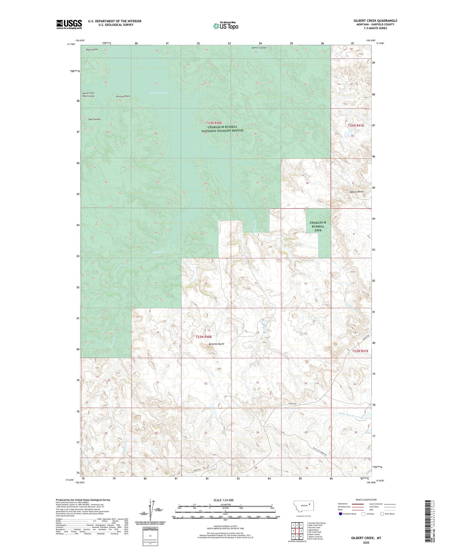
2024 topographic map quadrangle Gilbert Creek in the state of Montana. Scale: 1:24000. Based on the newly updated USGS 7.5' US Topo map series, this map is in the following counties: Garfield. The map contains contour data, water features, and other items you are used to seeing on USGS maps, but also has updated roads and other features. This is the next generation of topographic maps. Printed on high-quality waterproof paper with UV fade-resistant inks.
Quads adjacent to this one:
West: Signal Butte
Northwest: Seventh Point Buttes
North: Sage Creek Point
Northeast: Norville Creek
East: Ash Creek West
Southeast: Flat Creek School
South: Gilbert Creek SE
Southwest: Kester School
This map covers the same area as the classic USGS quad with code o47106f5.
Contains the following named places: 21N41E30AC_01_ Well, Brownie Butte, Claribell Number 10 Dam, Claribell Number 7 Dam, Claribell Number 8 Dam, Claribell Number 9 Dam, Dog Coulee, East Gilbert Creek, Gamas Reservoir Dam, Gilbert Creek, Kay Coulee, Kincaid Point, North Fork Dog Coulee, Square Butte