MyTopo
Short Creek Montana US Topo Map
Couldn't load pickup availability
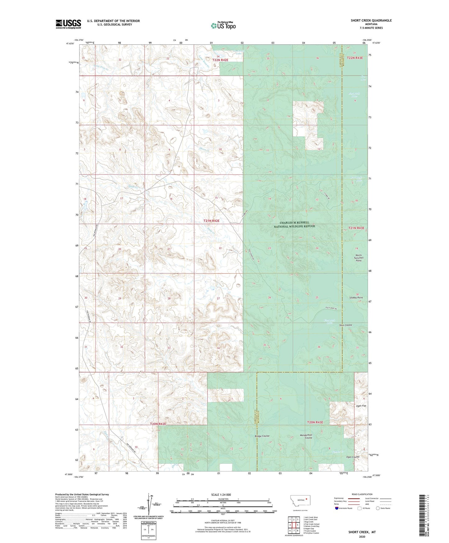
2024 topographic map quadrangle Short Creek in the state of Montana. Scale: 1:24000. Based on the newly updated USGS 7.5' US Topo map series, this map is in the following counties: Garfield, McCone. The map contains contour data, water features, and other items you are used to seeing on USGS maps, but also has updated roads and other features. This is the next generation of topographic maps. Printed on high-quality waterproof paper with UV fade-resistant inks.
Quads adjacent to this one:
West: Flat Creek School
Northwest: Ash Creek West
North: Ash Creek East
Northeast: Bug Creek
East: Nelson Creek Bay
Southeast: Fortyfour Coulee
South: Frank Coulee
Southwest: Hagen Gap
This map covers the same area as the classic USGS quad with code o47106e3.
Contains the following named places: 21N42E14CC__01 Well, 21N42E15DC__01 Well, 21N42E15DDCC01 Well, 22N42E34CC__01 Well, Big Dry Creek, Bridge Coulee, Claribell Number 11 Dam, Egan Coulee, Egan Flat, Flint Ranch, Lone Tree Creek, Mendenhall Coulee, Short Creek, Shot Coulee, Snap Creek, Stubby Point, Timber Creek, Twitchell Number 2 Dam, Twitchell Post Office