
MyTopo
Fort Peck Montana US Topo Map
Couldn't load pickup availability
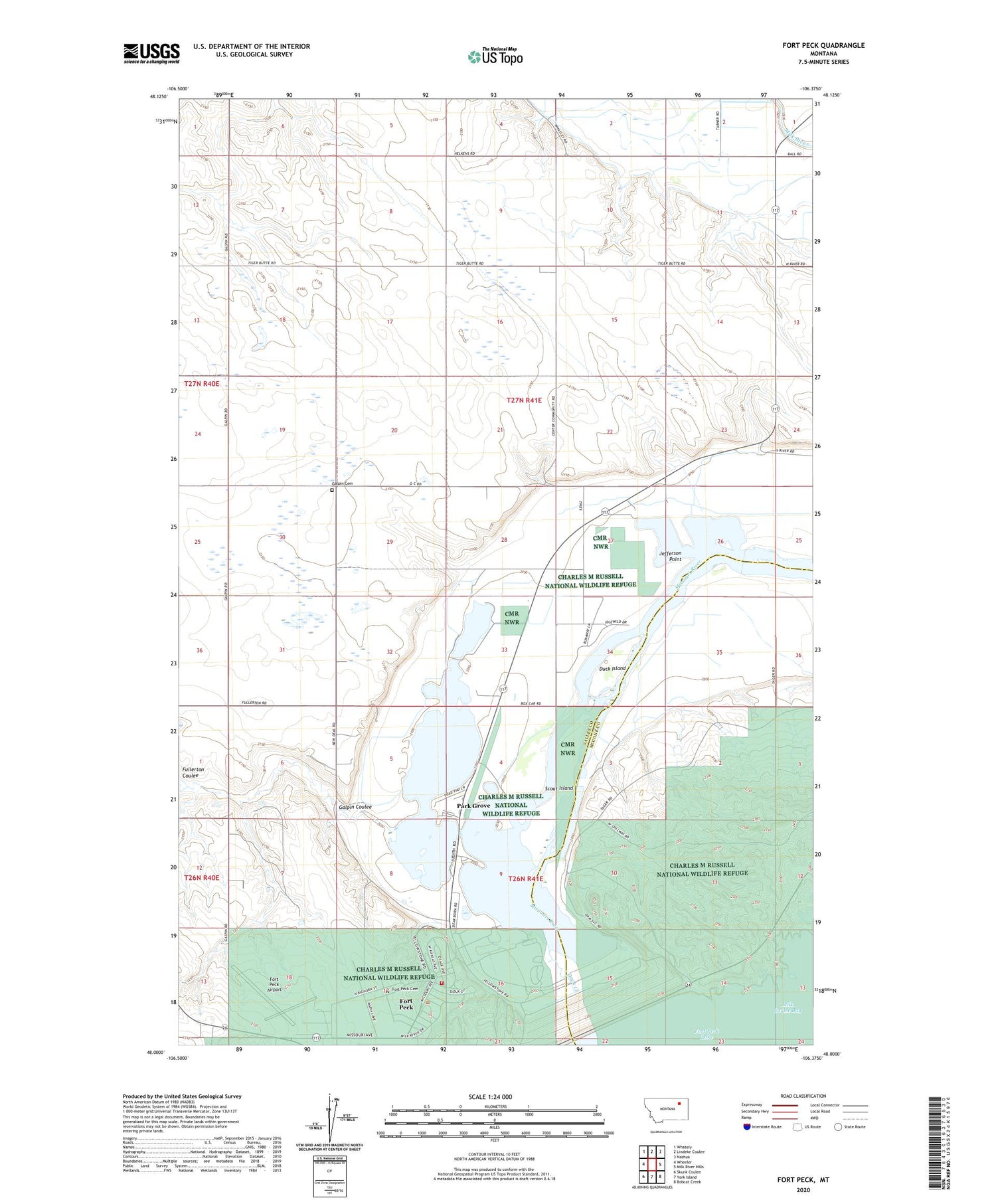
2020 topographic map quadrangle Fort Peck in the state of Montana. Scale: 1:24000. Based on the newly updated USGS 7.5' US Topo map series, this map is in the following counties: Valley, McCone. The map contains contour data, water features, and other items you are used to seeing on USGS maps, but also has updated roads and other features. This is the next generation of topographic maps. Printed on high-quality waterproof paper with UV fade-resistant inks.
Quads adjacent to this one:
West: Wheeler
Northwest: Whately
North: Lindeke Coulee
Northeast: Nashua
East: Milk River Hills
Southeast: Bobcat Creek
South: York Island
Southwest: Skunk Coulee
Contains the following named places: 27N41E05DDDC01 Well, Big Muddy Park, Cactus Flat, Center Consolidated School, Charles M Russell NWR Station, Coleman Wildlife Park, Delano Heights, Downstream Recreation Area, Duck Creek, Duck Island, Flag Pole Park, Fort Galpin, Fort Kaiser, Fort Peck, Fort Peck Airport, Fort Peck Cemetery, Fort Peck Chapel, Fort Peck Dam, Fort Peck Dredge Cuts Fishing Access Site, Fort Peck Post Office, Fort Peck School, Fort Peck Trout Pond, Fort Peck Volunteer Fire Department, Free Deal, Fullerton Coulee, Galpin Cemetery, Galpin Church, Galpin Coulee, Galpin Post Office, Idlewile, Jefferson Point, John Hahn Memorial Field, Lakeview, Mall Park, McCone City, McCone City Post Office, McCone City School, Midway, New Deal, New Deal Post Office, Old Fort Peck Historical Marker, Osage Circle Park, Panton School, Park Dale, Park Grove, Powerhouse Museum, Scout Island, Square Deal, Stevens Point School, Taylor School, Town of Fort Peck, Trout Pond Recreation Area


