MyTopo
York Island Montana US Topo Map
Couldn't load pickup availability
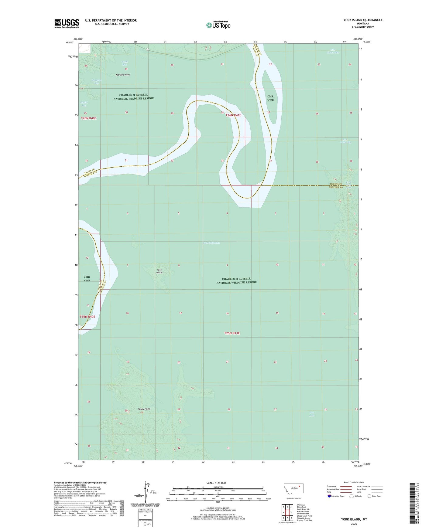
2024 topographic map quadrangle York Island in the state of Montana. Scale: 1:24000. Based on the newly updated USGS 7.5' US Topo map series, this map is in the following counties: Garfield, Valley, McCone. The map contains contour data, water features, and other items you are used to seeing on USGS maps, but also has updated roads and other features. This is the next generation of topographic maps. Printed on high-quality waterproof paper with UV fade-resistant inks.
Quads adjacent to this one:
West: Skunk Coulee
Northwest: Wheeler
North: Fort Peck
Northeast: Milk River Hills
East: Bobcat Creek
Southeast: Spring Creek Bay
South: Norville Creek
Southwest: Sage Creek Point
This map covers the same area as the classic USGS quad with code o47106h4.
Contains the following named places: Big Dry Post Office, Fort Peck Post Office, Fort Peck Recreation Area, Haxby Point, Markles Point, Perch Bay, Sturgeon Bay, York Island