MyTopo
Skunk Coulee Montana US Topo Map
Couldn't load pickup availability
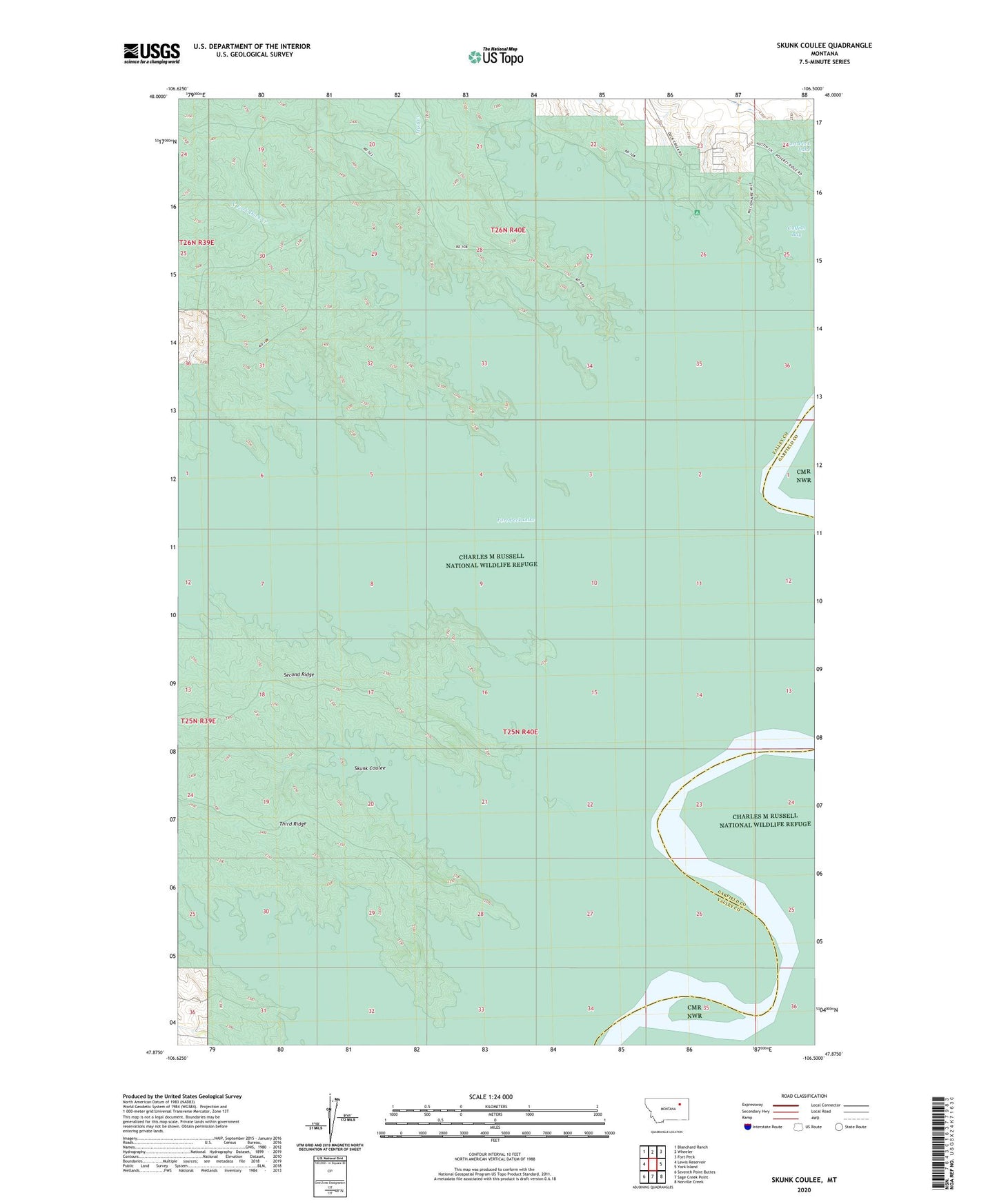
2024 topographic map quadrangle Skunk Coulee in the state of Montana. Scale: 1:24000. Based on the newly updated USGS 7.5' US Topo map series, this map is in the following counties: Valley, Garfield. The map contains contour data, water features, and other items you are used to seeing on USGS maps, but also has updated roads and other features. This is the next generation of topographic maps. Printed on high-quality waterproof paper with UV fade-resistant inks.
Quads adjacent to this one:
West: Lewis Reservoir
Northwest: Blanchard Ranch
North: Wheeler
Northeast: Fort Peck
East: York Island
Southeast: Norville Creek
South: Sage Creek Point
Southwest: Seventh Point Buttes
This map covers the same area as the classic USGS quad with code o47106h5.
Contains the following named places: Catfish Bay, Duck Creek Fishing Access Site, Duck Creek Recreation Area, Lismas, Lismas Post Office, North Fork Duck Creek, Second Point School, Second Ridge, Skunk Coulee, South Fork Duck Creek, Third Point School, Third Ridge, West End Campground