MyTopo
Government Hill SE Montana US Topo Map
Couldn't load pickup availability
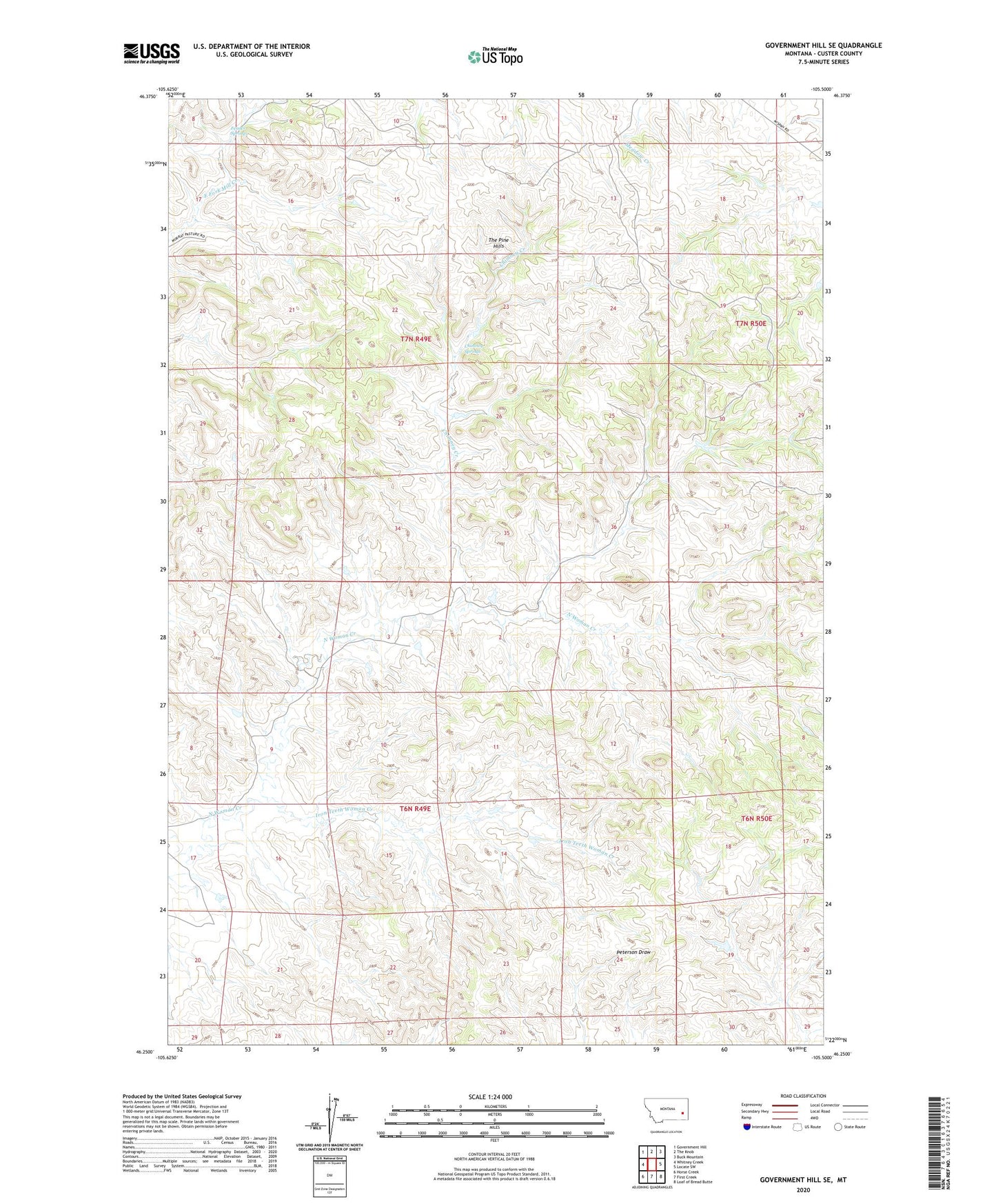
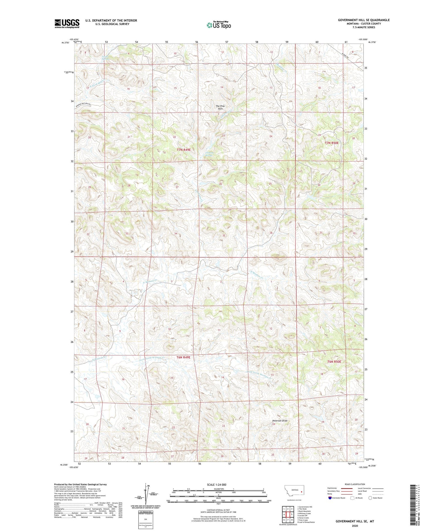
2020 topographic map quadrangle Government Hill SE in the state of Montana. Scale: 1:24000. Based on the newly updated USGS 7.5' US Topo map series, this map is in the following counties: Custer. The map contains contour data, water features, and other items you are used to seeing on USGS maps, but also has updated roads and other features. This is the next generation of topographic maps. Printed on high-quality waterproof paper with UV fade-resistant inks.
Quads adjacent to this one:
West: Whitney Creek
Northwest: Government Hill
North: The Knob
Northeast: Buck Mountain
East: Locate SW
Southeast: Loaf of Bread Butte
South: First Creek
Southwest: Horse Creek
Contains the following named places: 07N48E28DBCD01 Well, Chimney Creek, Chimney Springs, Custer County, Fessler Springs, Iron Teeth Woman Creek, Jones Number 4 Dam, Severson Number 3 Dam, Sunshine Camp