MyTopo
Buck Mountain Montana US Topo Map
Couldn't load pickup availability
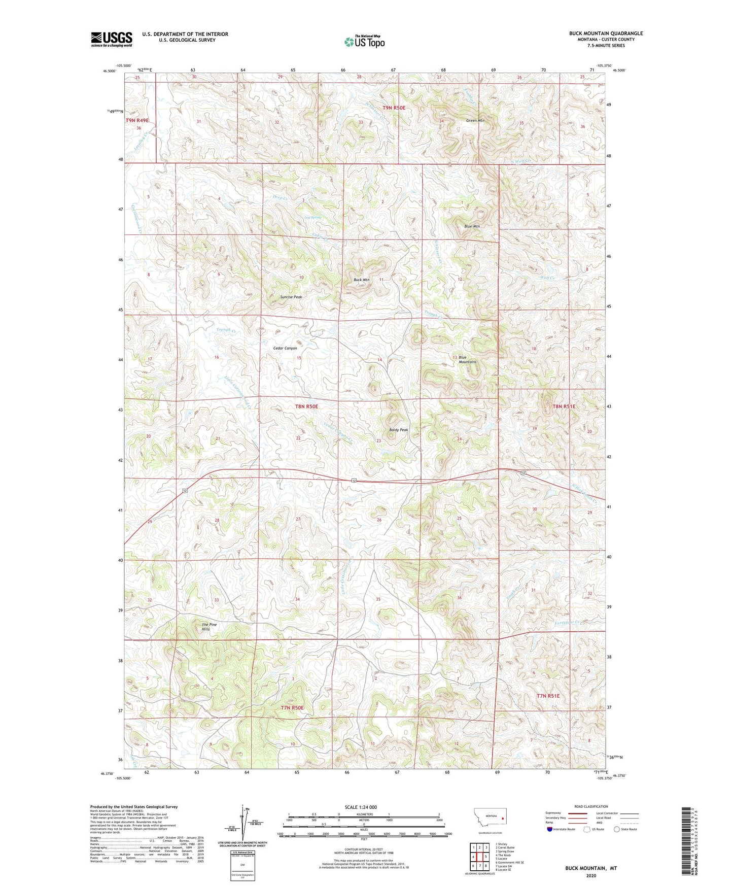
2024 topographic map quadrangle Buck Mountain in the state of Montana. Scale: 1:24000. Based on the newly updated USGS 7.5' US Topo map series, this map is in the following counties: Custer. The map contains contour data, water features, and other items you are used to seeing on USGS maps, but also has updated roads and other features. This is the next generation of topographic maps. Printed on high-quality waterproof paper with UV fade-resistant inks.
Quads adjacent to this one:
West: The Knob
Northwest: Shirley
North: Corral Butte
Northeast: Spring Draw
East: Locate
Southeast: Locate SE
South: Locate SW
Southwest: Government Hill SE
This map covers the same area as the classic USGS quad with code o46105d4.
Contains the following named places: 07N50E02BBBB01 Well, 08N50E05BDAA01 Well, Baldy Peak, Blue Mountain, Blue Mountains, Buck Mountain, Cabin Creek, Cedar Canyon, Cedar Canyon Creek, Deep Creek, Green Mountain, Levalley Creek, Little Cottonwood Creek, Log Spring, Ogdahl Number 3 Dam, Sunrise Peak, Trough Creek