MyTopo
Government Hill Montana US Topo Map
Couldn't load pickup availability
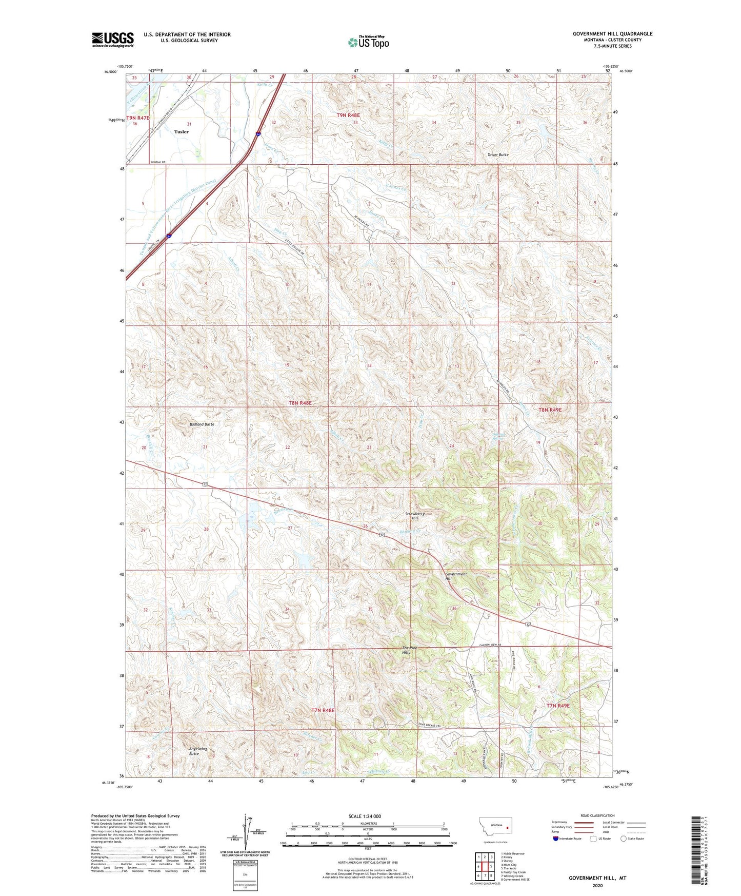
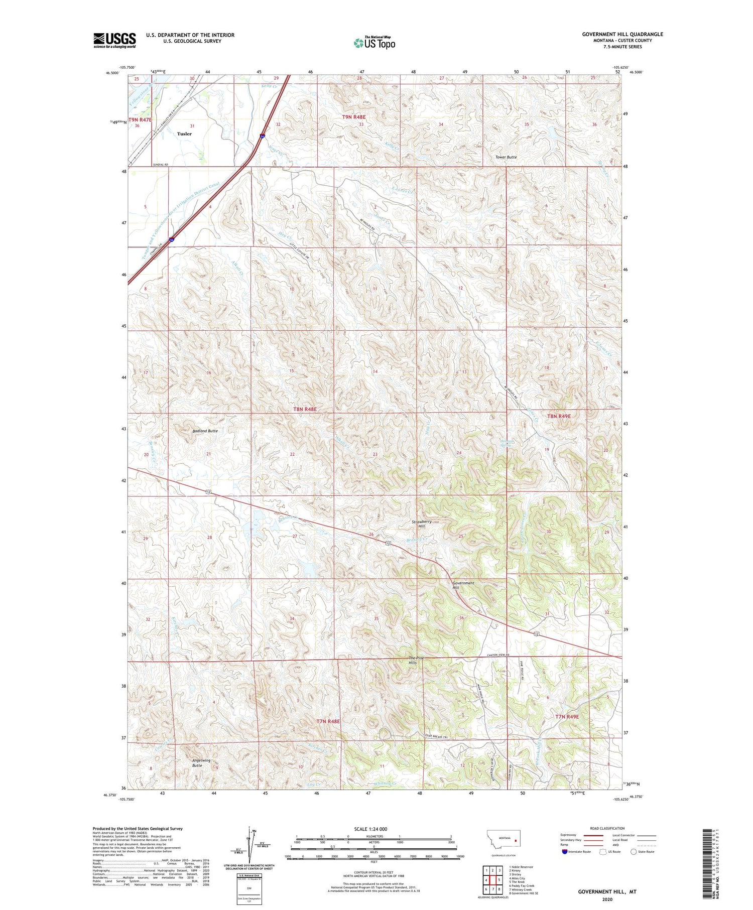
2020 topographic map quadrangle Government Hill in the state of Montana. Scale: 1:24000. Based on the newly updated USGS 7.5' US Topo map series, this map is in the following counties: Custer. The map contains contour data, water features, and other items you are used to seeing on USGS maps, but also has updated roads and other features. This is the next generation of topographic maps. Printed on high-quality waterproof paper with UV fade-resistant inks.
Quads adjacent to this one:
West: Miles City
Northwest: Noble Reservoir
North: Kinsey
Northeast: Shirley
East: The Knob
Southeast: Government Hill SE
South: Whitney Creek
Southwest: Paddy Fay Creek
Contains the following named places: 08N48E02DCBA01 Well, 08N48E04CDDC01 Well, 08N48E36DBDA01 Well, 08N48E36DBDB01 Well, 08N49E07DBDB01 Well, 08N53E25CAD_01 Well, Angelwing Butte, Badland Butte, Drennin Spring, East Jones Creek, Glasscock Number 1 Dam, Government Hill, Hay Creek, Herzog Number 1 Dam, Herzog Number 2 Dam, Herzog Number 3 Dam, KMCM-FM (Miles City), KMTA-AM (Kinsey), KMTA-AM (Miles City), South Fork Jones Creek, Strawberry Hill, Strawberry Hill Recreation Area, Sunday Creek, Tower Butte, Tusler School, Whitney Creek