MyTopo
Haymaker Narrows Montana US Topo Map
Couldn't load pickup availability
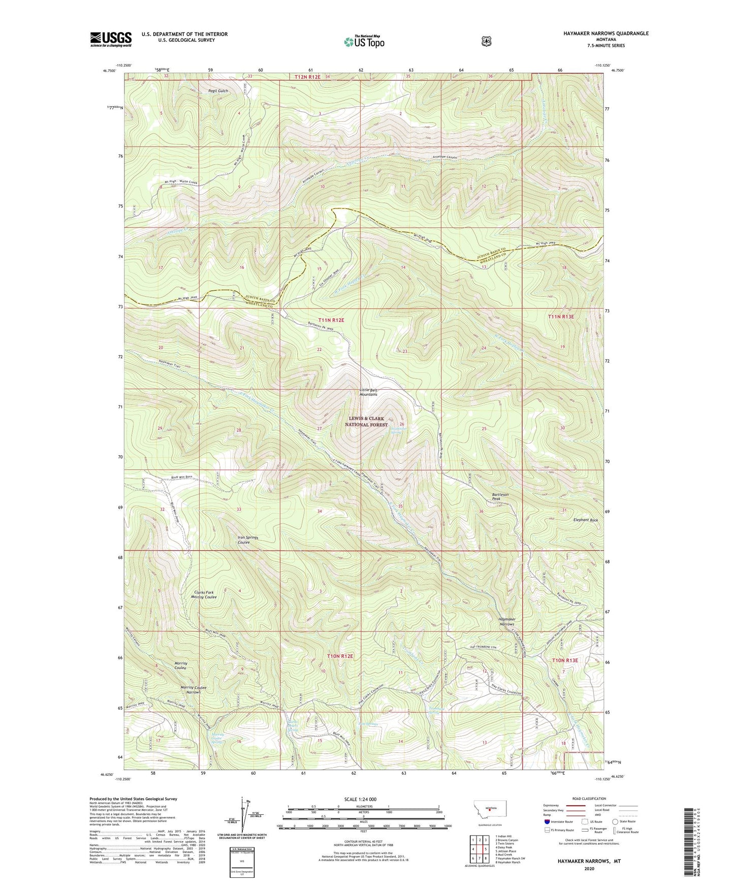
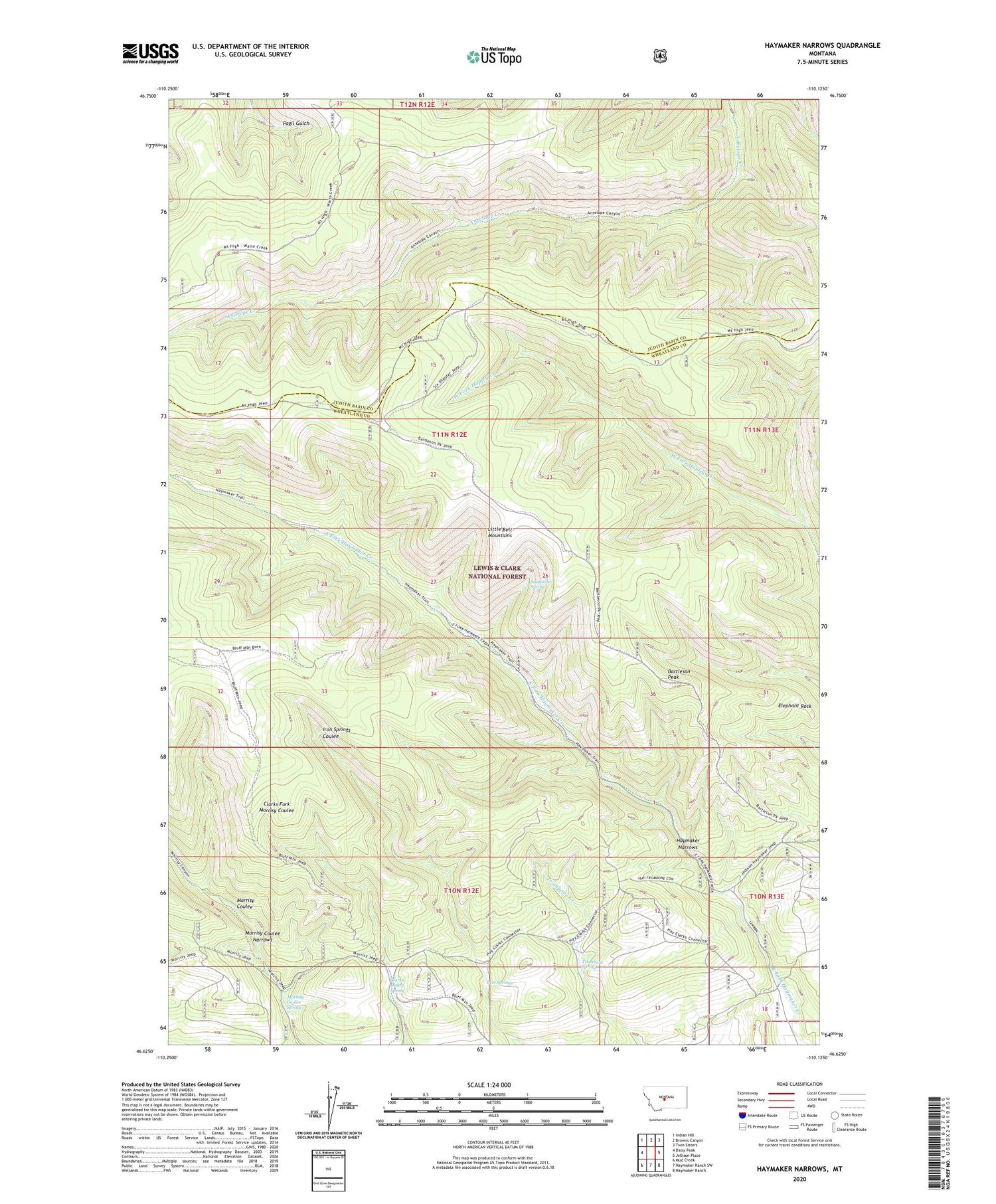
2020 topographic map quadrangle Haymaker Narrows in the state of Montana. Scale: 1:24000. Based on the newly updated USGS 7.5' US Topo map series, this map is in the following counties: Wheatland, Judith Basin. The map contains contour data, water features, and other items you are used to seeing on USGS maps, but also has updated roads and other features. This is the next generation of topographic maps. Printed on high-quality waterproof paper with UV fade-resistant inks.
Quads adjacent to this one:
West: Daisy Peak
Northwest: Indian Hill
North: Browns Canyon
Northeast: Twin Sisters
East: Jellison Place
Southeast: Haymaker Ranch
South: Haymaker Ranch SW
Southwest: Mud Creek
Contains the following named places: Bartleson Peak, Clarks Desert Spring, Elephant Rock, Haymaker Dam, Haymaker Narrows, Iron Springs, Morrisy Coulee Narrows, Morrisy Coulee Spring, Sixshooter Spring, Trombone Spring