MyTopo
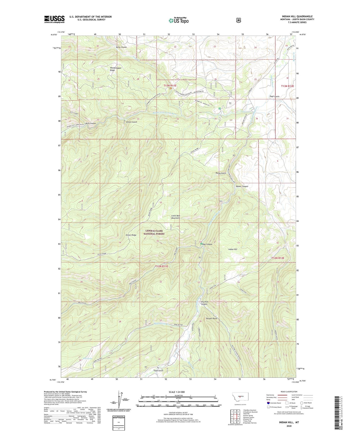
Indian Hill Montana US Topo Map
Couldn't load pickup availability
Also explore the Indian Hill Forest Service Topo of this same quad for updated USFS data
2024 topographic map quadrangle Indian Hill in the state of Montana. Scale: 1:24000. Based on the newly updated USGS 7.5' US Topo map series, this map is in the following counties: Judith Basin. The map contains contour data, water features, and other items you are used to seeing on USGS maps, but also has updated roads and other features. This is the next generation of topographic maps. Printed on high-quality waterproof paper with UV fade-resistant inks.
Quads adjacent to this one:
West: Ettien Spring
Northwest: Bandbox Mountain
North: Woodhurst Mountain
Northeast: Red Hill
East: Browns Canyon
Southeast: Haymaker Narrows
South: Daisy Peak
Southwest: Russian Flat
This map covers the same area as the classic USGS quad with code o46110g3.
Contains the following named places: 13N11E25DA__01 Well, 13N11E25DA__02 Well, 13N11E25DA__03 Well, 13N11E26BD__01 Well, 13N11E26BD__02 Well, 13N11E35AB__01 Well, 13N11E36DA__01 Well, 13N12E19BD__01 Well, 13N12E19CA__01 Well, 13N12E30BA__01 Well, American Mine, Arch Coulee, Bower Canyon, Burley Creek, Dry Pole Campground, Dry Pole Canyon, Ettien Gulch, Fred M Ellis Memorial Campground, Hay Canyon, Hay Canyon Campground, High Spring, High Spring Creek, Indian Hill, Indian Hill Campground, Judith Ranger Station, Kelly Coulee, Korells Dude Ranch, Middle Fork Judith River, NW SE Section 20 Mine, Pagil Gulch, Rocky Gulch, Russell Point, Sapphire Post Office, South Fork Judith River, Trask Gulch, Trask Ranch, Vortex Mine, Yogo Creek, Yogo Crossing