MyTopo
Hilger Montana US Topo Map
Couldn't load pickup availability
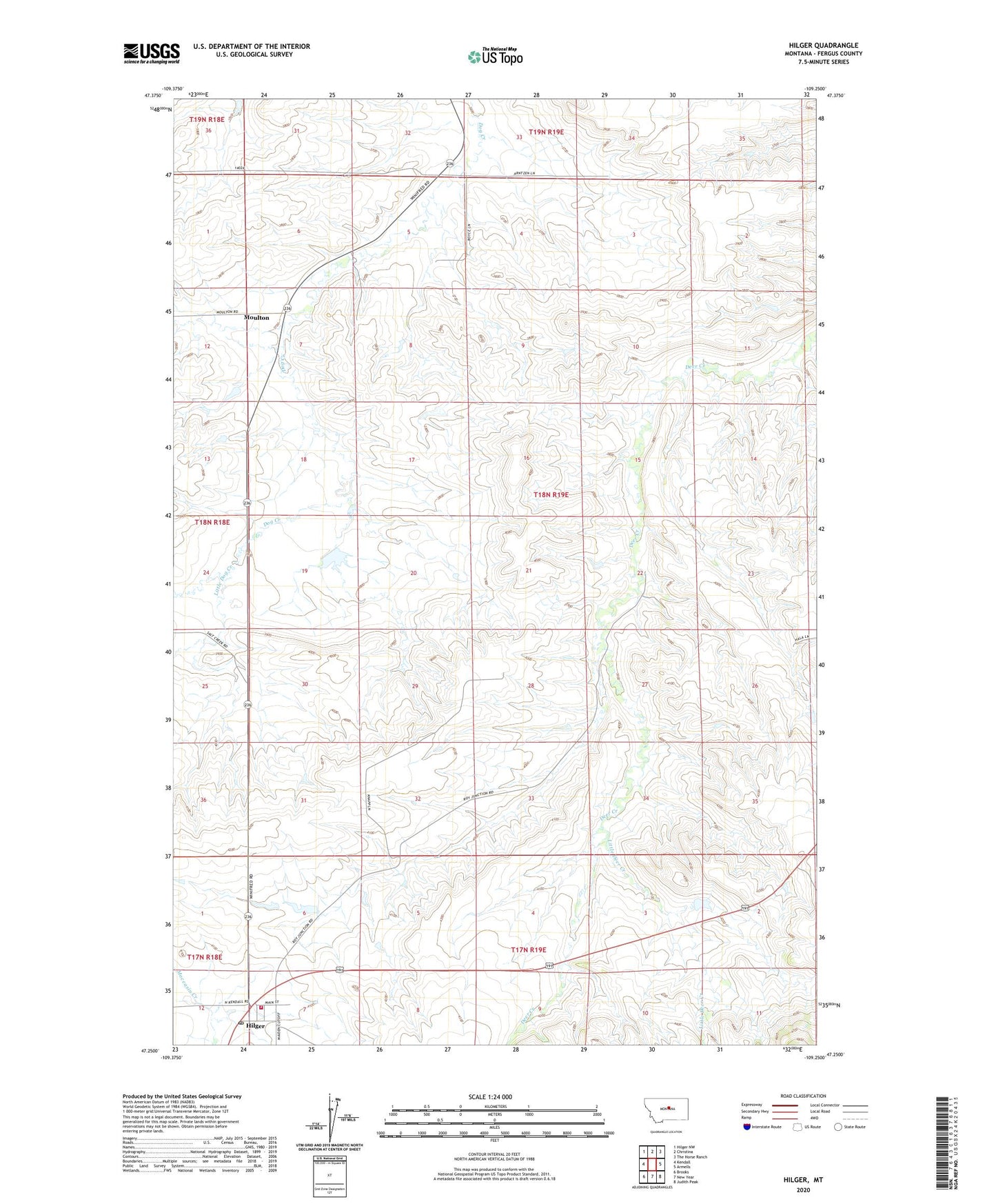
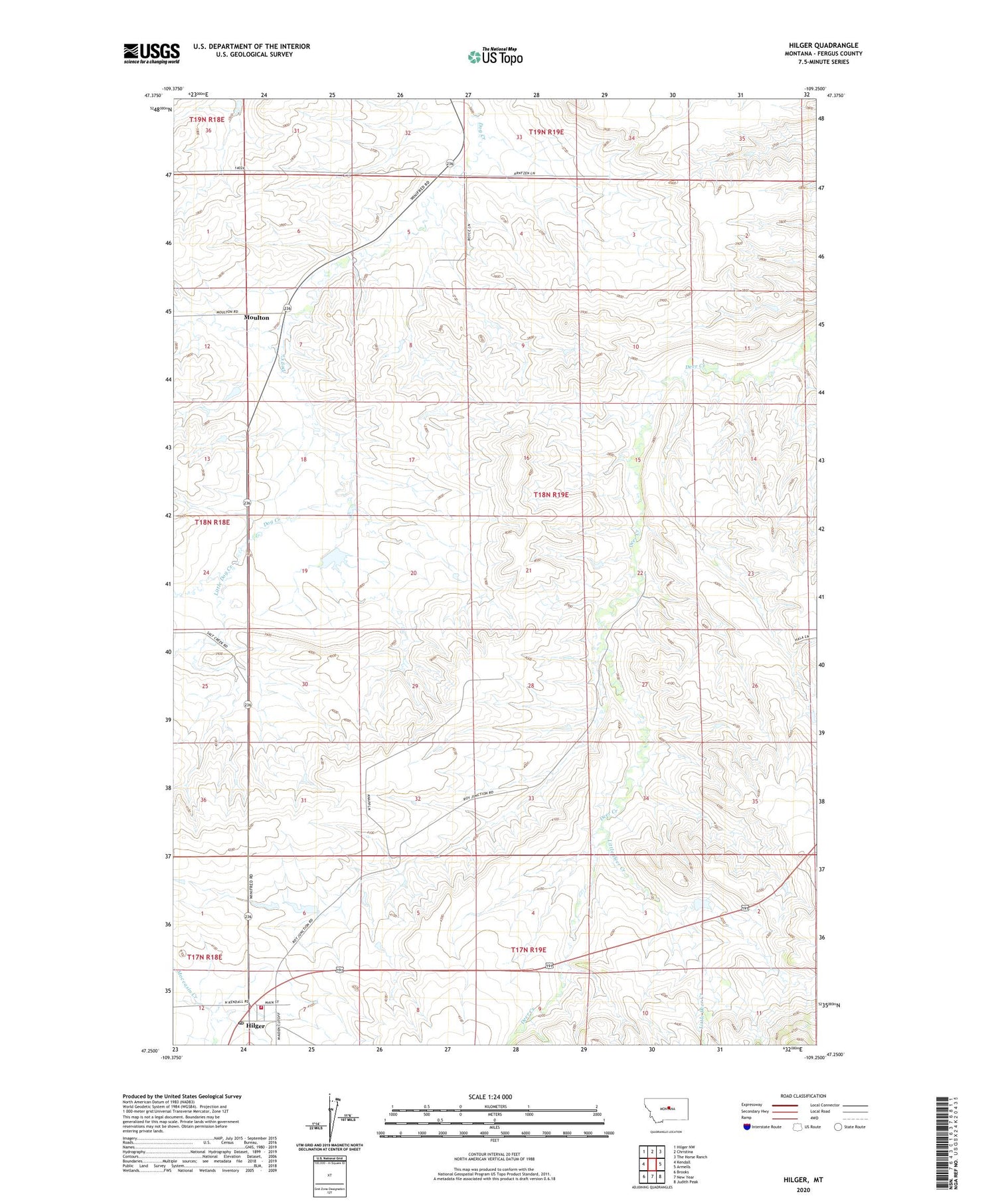
2020 topographic map quadrangle Hilger in the state of Montana. Scale: 1:24000. Based on the newly updated USGS 7.5' US Topo map series, this map is in the following counties: Fergus. The map contains contour data, water features, and other items you are used to seeing on USGS maps, but also has updated roads and other features. This is the next generation of topographic maps. Printed on high-quality waterproof paper with UV fade-resistant inks.
Quads adjacent to this one:
West: Kendall
Northwest: Hilger NW
North: Christina
Northeast: The Horse Ranch
East: Armells
Southeast: Judith Peak
South: New Year
Southwest: Brooks
Contains the following named places: 17N18E01ABAC01 Well, 17N19E07BBC_01 Well, 17N19E07BC__01 Well, 17N19E07BC__02 Well, 18N18E12ACA_01 Well, 18N18E24DCD_01 Well, 18N19E08ABB_01 Well, 18N19E08BCD_01 Well, 18N19E18DA__01 Well, 18N19E19BBB_01 Well, 18N19E28BCA_01 Well, 18N19E31CCC_01 Well, 18N19E31CCCD01 Well, 18N19E33AAA_01 Well, Hilger, Hilger Census Designated Place, Hilger Fire Department, Hilger Post Office, Hilger School, Little Deer Creek, Little Dog Creek, Moulton, Moulton Post Office, Presbyterian Church, Roy Junction, Roy Junction School, Saint Victor Church, Van Haur Dam