MyTopo
Brooks Montana US Topo Map
Couldn't load pickup availability
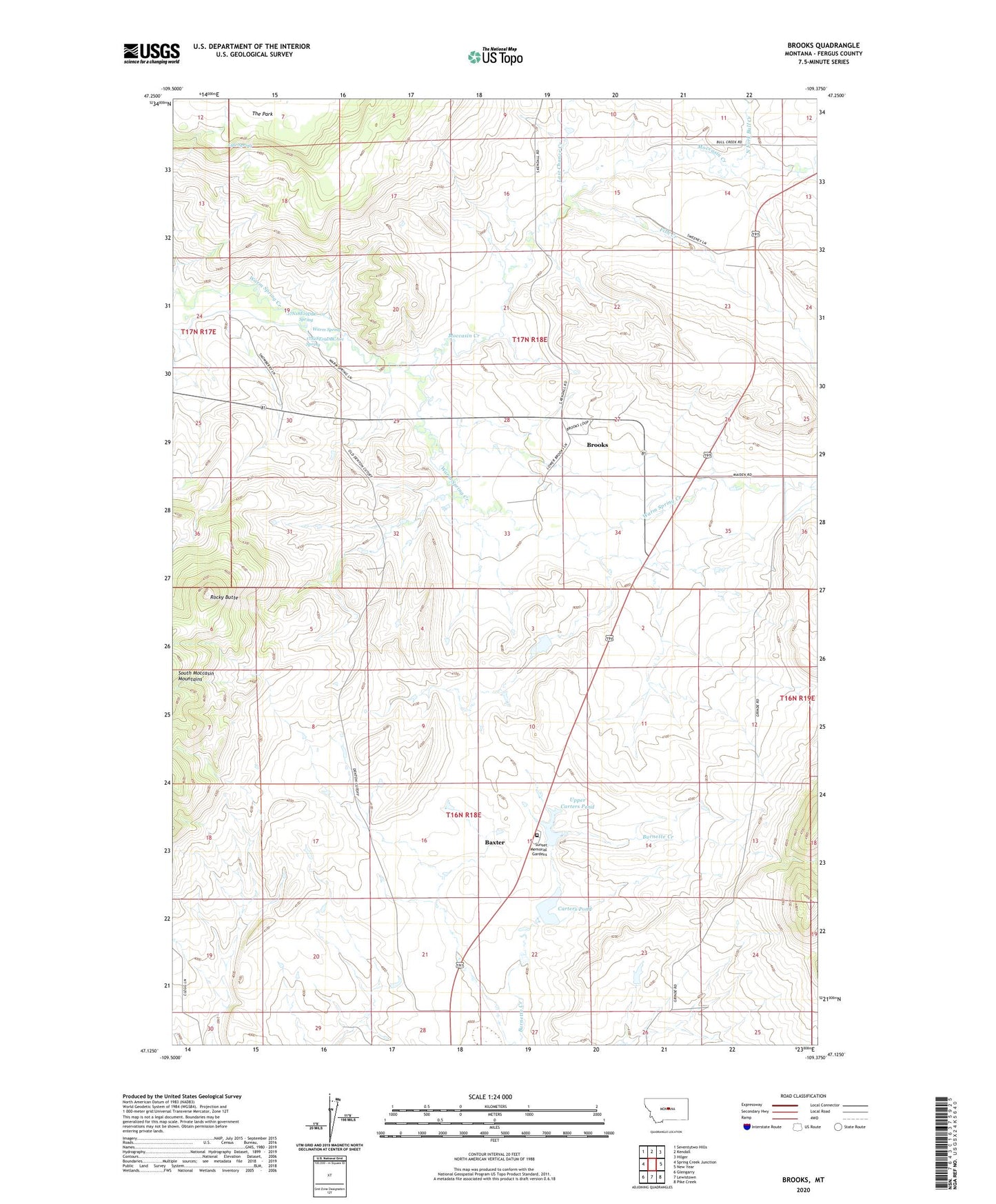
2024 topographic map quadrangle Brooks in the state of Montana. Scale: 1:24000. Based on the newly updated USGS 7.5' US Topo map series, this map is in the following counties: Fergus. The map contains contour data, water features, and other items you are used to seeing on USGS maps, but also has updated roads and other features. This is the next generation of topographic maps. Printed on high-quality waterproof paper with UV fade-resistant inks.
Quads adjacent to this one:
West: Spring Creek Junction
Northwest: Seventytwo Hills
North: Kendall
Northeast: Hilger
East: New Year
Southeast: Pike Creek
South: Lewistown
Southwest: Glengarry
This map covers the same area as the classic USGS quad with code o47109b4.
Contains the following named places: 16N18E08CAA_01 Well, 16N18E08CAB_01 Well, 16N18E13DBB_01 Well, 16N18E15ACCB01 Well, 16N18E15BDBB01 Well, 17N17E24ACC_01 Well, 17N17E25AACC01 Well, 17N18E19DBC_01 Spring, 17N18E19DBCA01 Spring, 17N18E23ADB_01 Well, 17N18E27CBD_01 Well, 17N18E30CAC_01 Well, 17N18E33ADC_01 Well, 17N18E34ACA_01 Well, Baxter, Brooks, Brooks Census Designated Place, Brooks Post Office, Brooks School, Carters Pond, Central Montana Memorial Gardens, Colver Dam, Fish Creek, Last Chance Creek, Lower Carter Pond Dam, Lower Carter Pond Fishing Access Site, Lucier School, Lyle Spring, Maidens Gold Historical Marker, Moccasin Creek, North Fork Bull Creek, Philips School, Rocky Butte, Upper Carter Pond Dam, Upper Carter Pond Fishing Access Site, Upper Carters Pond, Warm Spring