MyTopo
Horse Creek Montana US Topo Map
Couldn't load pickup availability
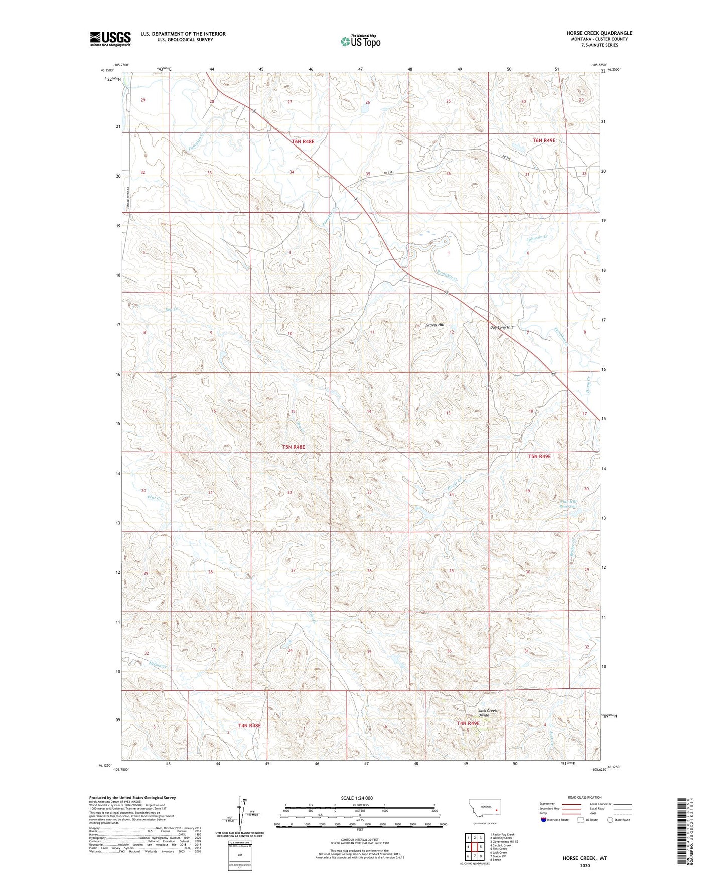
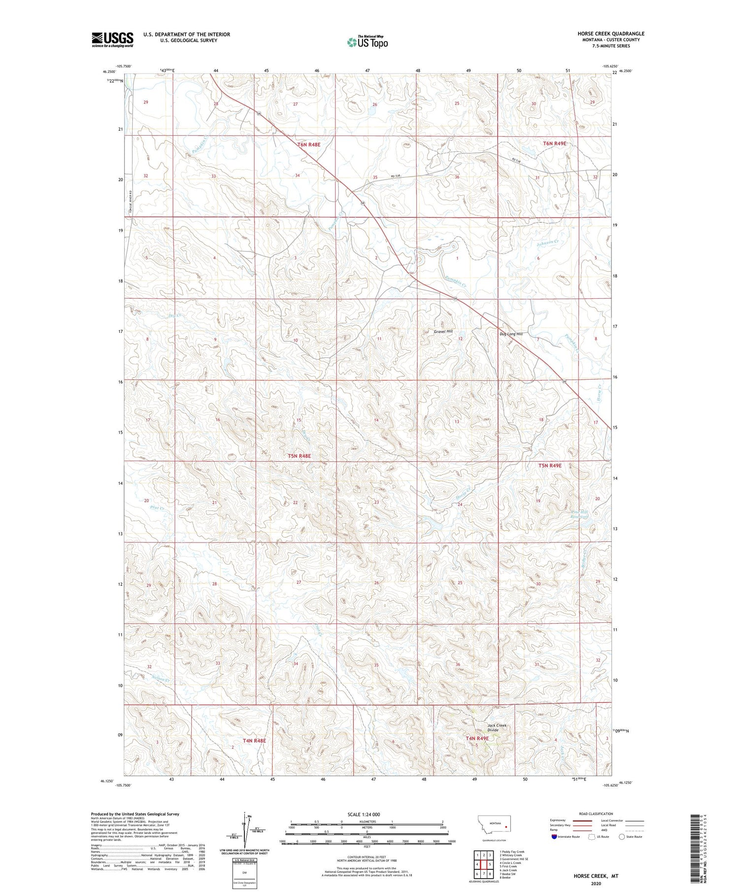
2020 topographic map quadrangle Horse Creek in the state of Montana. Scale: 1:24000. Based on the newly updated USGS 7.5' US Topo map series, this map is in the following counties: Custer. The map contains contour data, water features, and other items you are used to seeing on USGS maps, but also has updated roads and other features. This is the next generation of topographic maps. Printed on high-quality waterproof paper with UV fade-resistant inks.
Quads adjacent to this one:
West: Circle L Creek
Northwest: Paddy Fay Creek
North: Whitney Creek
Northeast: Government Hill SE
East: First Creek
Southeast: Beebe
South: Beebe SW
Southwest: Jack Creek
Contains the following named places: 04N49E04ABCD01 Well, 05N48E02DBDA01 Well, 05N48E28BDBA01 Well, Cutler, Cutler Post Office, Dug Long Hill, Grace Community Church, Gravel Hill, Gray Dutch Inn, Horse Creek, Johnson Creek, Muri Number 4 Dam, Nichols Dam, Pine Hill Reservoir, Pine Hills Dam, Rodgers Dam, Rogers Number 2 Dam, Twelve Mile Dam Fishing Access Site