MyTopo
Inverness Montana US Topo Map
Couldn't load pickup availability
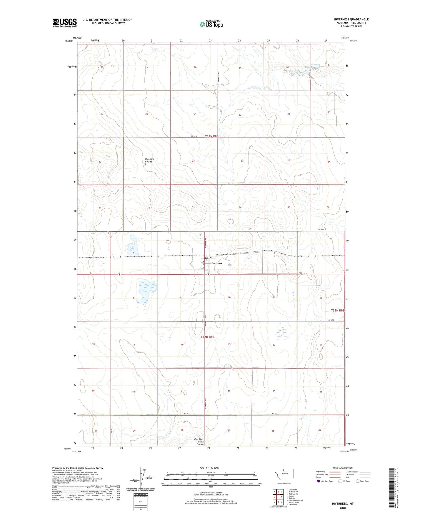
2024 topographic map quadrangle Inverness in the state of Montana. Scale: 1:24000. Based on the newly updated USGS 7.5' US Topo map series, this map is in the following counties: Hill, Liberty. The map contains contour data, water features, and other items you are used to seeing on USGS maps, but also has updated roads and other features. This is the next generation of topographic maps. Printed on high-quality waterproof paper with UV fade-resistant inks.
Quads adjacent to this one:
West: Joplin
Northwest: Chester NE
North: Rudyard NW
Northeast: Rudyard NE
East: Rudyard
Southeast: Een School
South: Rocky Coulee
Southwest: Poverty Coulee NE
This map covers the same area as the classic USGS quad with code o48110e6.
Contains the following named places: 32N08E03ACA_01 Well, 33N08E15DDAB01 Well, Austin, Hingham Sandy Sage Dam, Inverness, Inverness Census Designated Place, Inverness Post Office, Inverness Rural Fire Department, Inverness School, Iverness, Joplin-Inverness School, Methodist Church United, Prescott Dam, Prescott Reservoir, Sacred Heart Church