MyTopo
Jewel Basin Montana US Topo Map
Couldn't load pickup availability
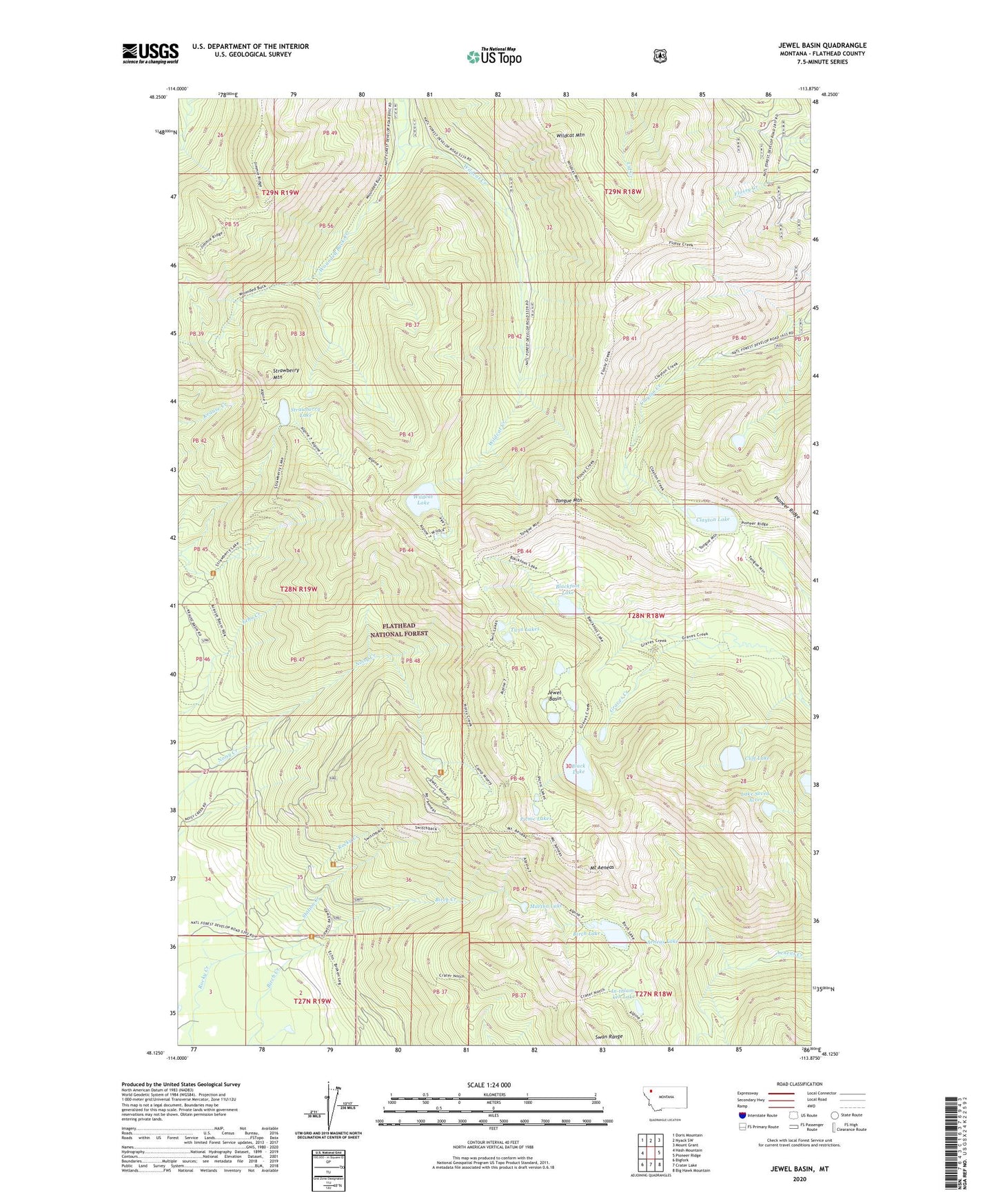
2020 topographic map quadrangle Jewel Basin in the state of Montana. Scale: 1:24000. Based on the newly updated USGS 7.5' US Topo map series, this map is in the following counties: Flathead. The map contains contour data, water features, and other items you are used to seeing on USGS maps, but also has updated roads and other features. This is the next generation of topographic maps. Printed on high-quality waterproof paper with UV fade-resistant inks.
Quads adjacent to this one:
West: Hash Mountain
Northwest: Doris Mountain
North: Nyack SW
Northeast: Mount Grant
East: Pioneer Ridge
Southeast: Big Hawk Mountain
South: Crater Lake
Southwest: Bigfork
Contains the following named places: Aeneas Creek Trail, Aeneas Lake, Birch Lake, Black Lake, Blackfoot Lake, Clayton Lake, Cliff Lake, Foothills Cross Country Ski Area, Foothills Cross-Country Ski Area, Graves Creek Trail, In-thlam-keh Lake, Jewel Basin, Jewel Basin Hiking Area, Jimmie Ridge Trail, Lake Seven Acres, Martha Lake, Mount Aeneas, Noisy Creek Notch Trail, Picnic Lakes, Pioneer Ridge, Pioneer Ridge Trail, Station Creek, Strawberry Lake, Strawberry Lake Forest Service Station, Strawberry Mountain, Tongue Mountain, Tongue Mountain Trail, Twin Lakes, Wildcat Creek, Wildcat Lake, Wildcat Mountain