MyTopo
Johnson Peak Montana US Topo Map
Couldn't load pickup availability
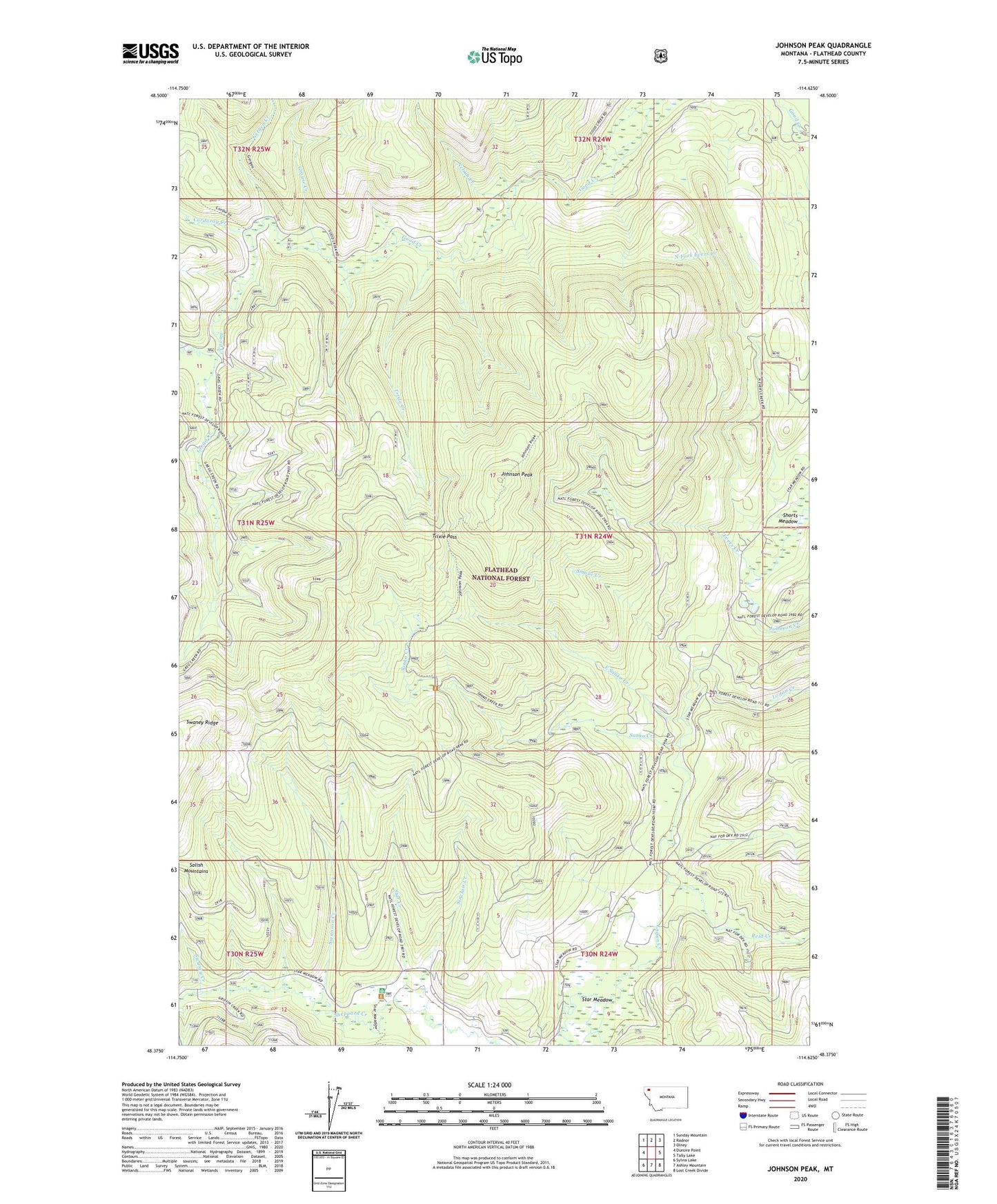
2020 topographic map quadrangle Johnson Peak in the state of Montana. Scale: 1:24000. Based on the newly updated USGS 7.5' US Topo map series, this map is in the following counties: Flathead. The map contains contour data, water features, and other items you are used to seeing on USGS maps, but also has updated roads and other features. This is the next generation of topographic maps. Printed on high-quality waterproof paper with UV fade-resistant inks.
Quads adjacent to this one:
West: Dunsire Point
Northwest: Sunday Mountain
North: Radnor
Northeast: Olney
East: Tally Lake
Southeast: Lost Creek Divide
South: Ashley Mountain
Southwest: Sylvia Lake
Contains the following named places: Alder Creek, Corduroy Creek, East Sanko Creek, Gergen Creek, Gregg Creek, Grouse Creek, Humdinger Mine, Johnson Peak, Nelson Creek, Reid Creek, Sanko Creek, Shorts Meadow, Sinclair Creek, Smoke Creek, Star Creek, Star Meadow Guard Station, Swaney Creek, Swanson Creek, Trixie Creek, Trixie Pass, Yukon Mine