MyTopo
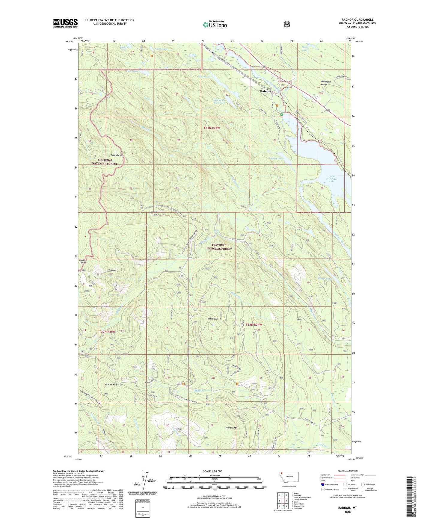
Radnor Montana US Topo Map
Couldn't load pickup availability
Also explore the Radnor Forest Service Topo of this same quad for updated USFS data
2024 topographic map quadrangle Radnor in the state of Montana. Scale: 1:24000. Based on the newly updated USGS 7.5' US Topo map series, this map is in the following counties: Flathead. The map contains contour data, water features, and other items you are used to seeing on USGS maps, but also has updated roads and other features. This is the next generation of topographic maps. Printed on high-quality waterproof paper with UV fade-resistant inks.
Quads adjacent to this one:
West: Sunday Mountain
Northwest: Stryker
North: Bull Lake
Northeast: Upper Whitefish Lake
East: Olney
Southeast: Tally Lake
South: Johnson Peak
Southwest: Dunsire Point
This map covers the same area as the classic USGS quad with code o48114e6.
Contains the following named places: 33N24W23ACAB01 Well, 59927, Adams Mountain, Burnt Lake, Duck Lake, Finger Lake, Fire Lakes, Fort Steele Trail, Grouse Mountain, Hole in the Wall Lake, Keith Mountain, Ketowke Mountain, Lagoni Lake, Le Beau Creek, Martin Falls, Martin Falls Campground, Martin Lakes, Miller Creek, Molly Lake, Radnor, Radnor School, Rock Creek, Smokey Lake, Upper Stillwater Campground, Upper Stillwater Lake