MyTopo
Kinsey Montana US Topo Map
Couldn't load pickup availability
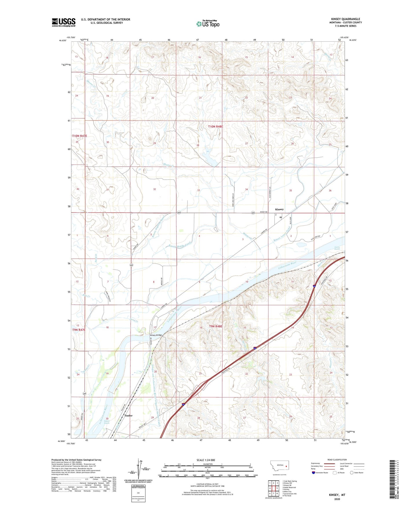
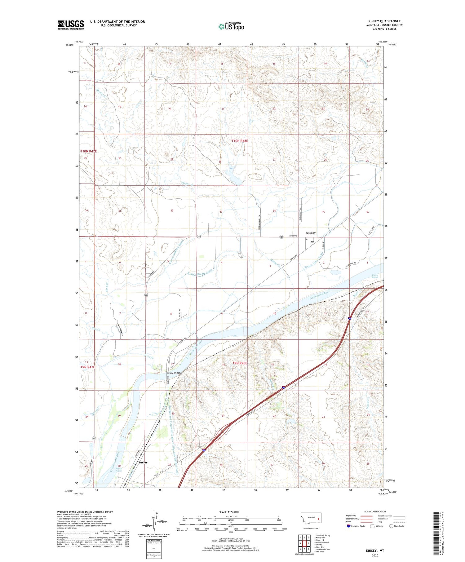
2020 topographic map quadrangle Kinsey in the state of Montana. Scale: 1:24000. Based on the newly updated USGS 7.5' US Topo map series, this map is in the following counties: Custer. The map contains contour data, water features, and other items you are used to seeing on USGS maps, but also has updated roads and other features. This is the next generation of topographic maps. Printed on high-quality waterproof paper with UV fade-resistant inks.
Quads adjacent to this one:
West: Noble Reservoir
Northwest: Coal Bank Spring
North: Kinsey NW
Northeast: Kinsey NE
East: Shirley
Southeast: The Knob
South: Government Hill
Southwest: Miles City
Contains the following named places: 09N48E01CBBC01 Well, 09N48E01CBCD01 Well, 09N48E02BABA01 Well, 09N48E02BABA02 Well, 09N48E02BBAD01 Well, 09N48E04BBBA01 Well, 09N48E07CABA01 Well, 09N48E08CDC_01 Well, 09N48E09BDDA01 Well, 09N48E18AAAD01 Well, 09N48E18CBC_01 Well, 09N48E18CBCC01 Well, 09N48E18CCCB01 Well, 10N48E25DBCC01 Well, 10N48E26DCDD01 Well, 10N48E32ADAB01 Well, 10N48E36ABBA01 Well, 10N48E36CDCB01 Well, 10N48E36DBCD01 Well, Buffalo Rapids, Canyon Springs, Custer County Rural Volunteer Fire Company Kinsey, Diamond Number 1 Dam, Dickson Post Office, Dixon Creek, Dixons Rapids, House Creek, Jones Creek, Kelly Creek, Kinsey, Kinsey Association of Churches Protestant Community Church, Kinsey Bridge, Kinsey Bridge Fishing Access Site, Kinsey Highline Canal, Kinsey Lower Canal, Kinsey Main Canal, Kinsey Middle Canal, Kinsey Number 2 Pumping Station, Kinsey Post Office, Kinsey School, Muster Creek, North Dixon Creek, Owens, Rice Creek, Sand Creek, Spring Creek, Stiles Number 1 Dam, Tree Creek, Tusler, Tusler Post Office, Watts Number 1 Dam