MyTopo
Lindeke Coulee Montana US Topo Map
Couldn't load pickup availability
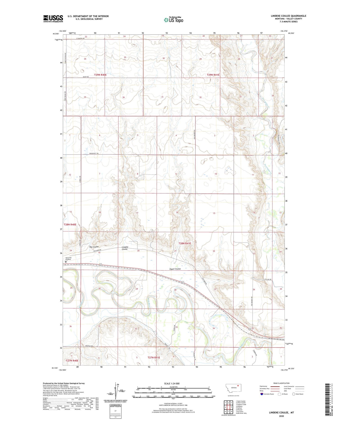
2020 topographic map quadrangle Lindeke Coulee in the state of Montana. Scale: 1:24000. Based on the newly updated USGS 7.5' US Topo map series, this map is in the following counties: Valley. The map contains contour data, water features, and other items you are used to seeing on USGS maps, but also has updated roads and other features. This is the next generation of topographic maps. Printed on high-quality waterproof paper with UV fade-resistant inks.
Quads adjacent to this one:
West: Whately
Northwest: Hawk Coulee
North: Uhlan Coulee
Northeast: Sargent Creek
East: Nashua
Southeast: Milk River Hills
South: Fort Peck
Southwest: Wheeler
Contains the following named places: 27N41E02BBDD01 Well, 28N41E20DBAB01 Well, 28N41E30BBAA01 Well, 28N41E32ABBD01 Well, 28N41E35DCCC01 Well, Accord, Accord School, Copeland School, Espeil Coulee, Hay Coulee, Lindeke Coulee, Memorial Gardens, Victory School