MyTopo
Lockhart Meadows Montana US Topo Map
Couldn't load pickup availability
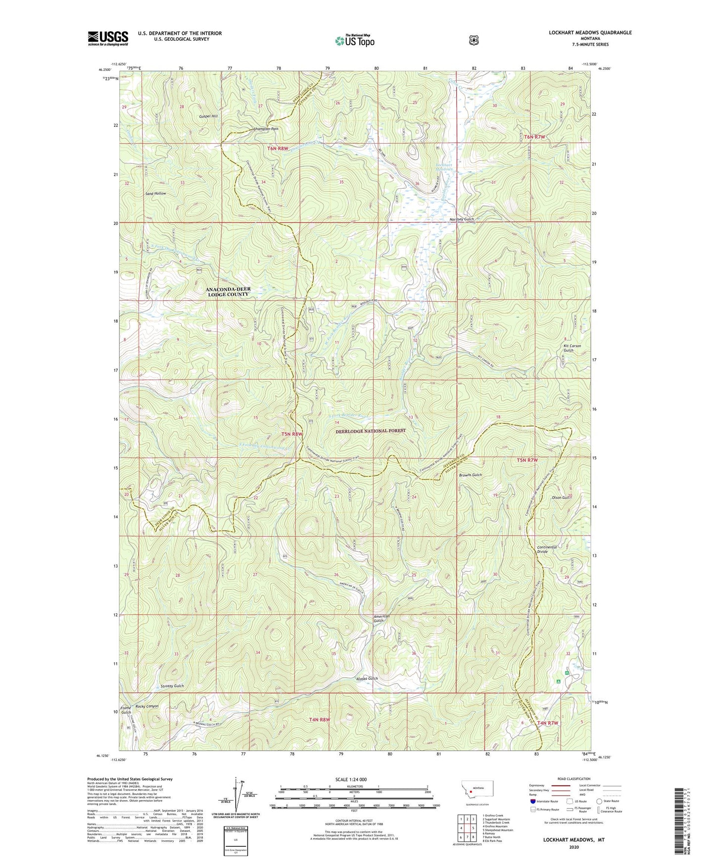
2020 topographic map quadrangle Lockhart Meadows in the state of Montana. Scale: 1:24000. Based on the newly updated USGS 7.5' US Topo map series, this map is in the following counties: Jefferson, Silver Bow, Deer Lodge. The map contains contour data, water features, and other items you are used to seeing on USGS maps, but also has updated roads and other features. This is the next generation of topographic maps. Printed on high-quality waterproof paper with UV fade-resistant inks.
Quads adjacent to this one:
West: Orofino Mountain
Northwest: Orofino Creek
North: Sugarloaf Mountain
Northeast: Thunderbolt Creek
East: Sheepshead Mountain
Southeast: Elk Park Pass
South: Butte North
Southwest: Ramsay
Contains the following named places: Alaska Gulch, American Gulch, American Mine, Cabin Creek, Champion, Champion Mine, Champion Pass, Champion Post Office, Champion School, Four Corners, Gospel Hill, Indian Creek, Lockhart Guard Station, Lockhart Meadows, Lockhart Post Office, Lockhart Ranch, Lowland Campground, Northey Gulch, NW NW Section 32 Mine, Powderhorn Creek, Rocky Canyon, Ruby Mine, South Fork Boulder River, Strozzy Gulch, West Fork Boulder River