MyTopo
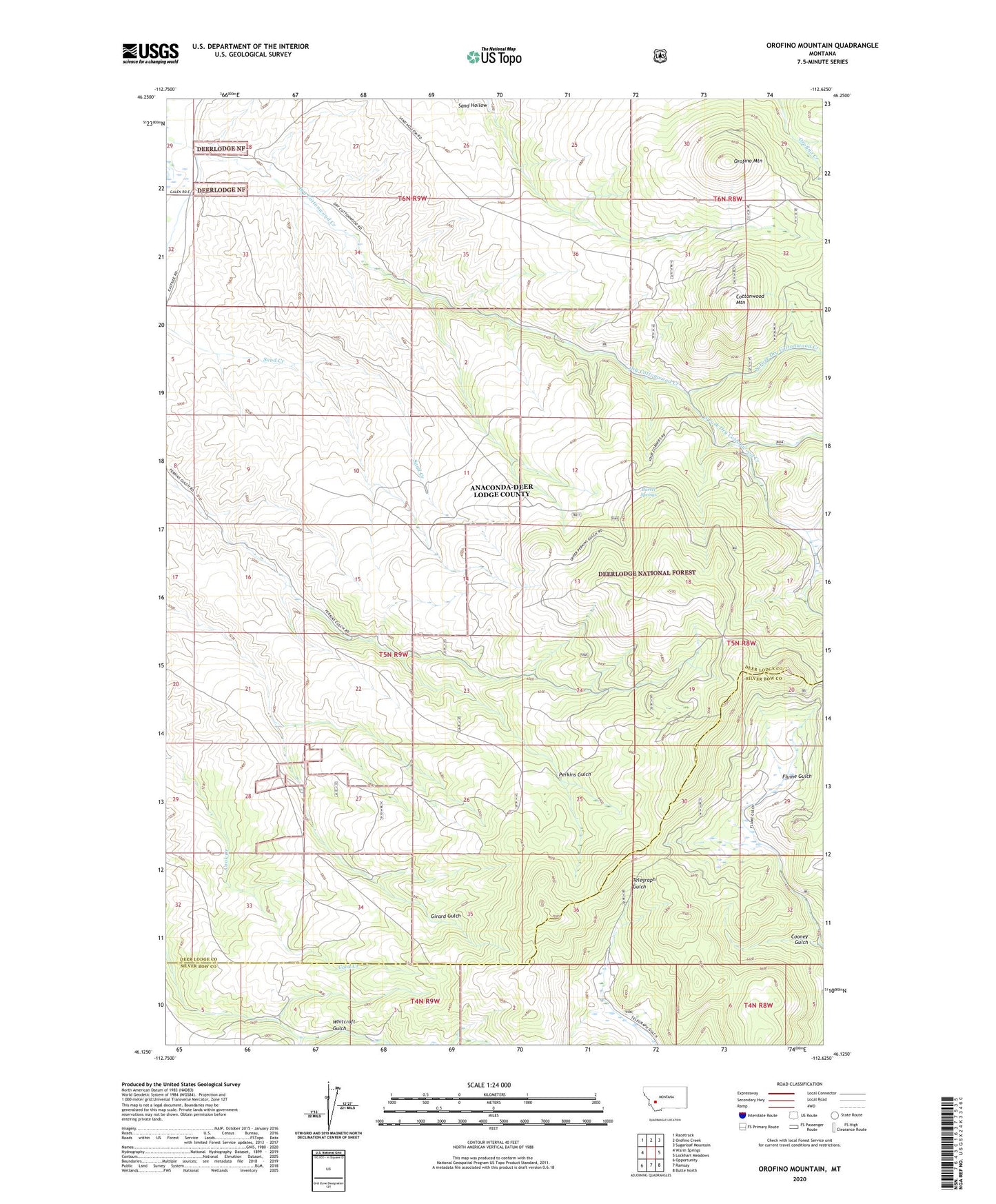
Orofino Mountain Montana US Topo Map
Couldn't load pickup availability
Also explore the Orofino Mountain Forest Service Topo of this same quad for updated USFS data
2024 topographic map quadrangle Orofino Mountain in the state of Montana. Scale: 1:24000. Based on the newly updated USGS 7.5' US Topo map series, this map is in the following counties: Deer Lodge, Silver Bow. The map contains contour data, water features, and other items you are used to seeing on USGS maps, but also has updated roads and other features. This is the next generation of topographic maps. Printed on high-quality waterproof paper with UV fade-resistant inks.
Quads adjacent to this one:
West: Warm Springs
Northwest: Racetrack
North: Orofino Creek
Northeast: Sugarloaf Mountain
East: Lockhart Meadows
Southeast: Butte North
South: Ramsay
Southwest: Opportunity
This map covers the same area as the classic USGS quad with code o46112b6.
Contains the following named places: 06N09W29DAAD01 Well, 06N09W32AA__01 Well, 06N09W32DDAB01 Well, Barrel Springs, Butte Pacific Mine, Cooney Gulch, Cottonwood Mountain, Dry Cottonwood Guard Station, North Fork Dry Cottonwood Creek, Orofino Mountain, South Fork Dry Cottonwood Creek, SW NE Section 5 Mine