MyTopo
Ramsay Montana US Topo Map
Couldn't load pickup availability
Also explore the Ramsay Forest Service Topo of this same quad for updated USFS data
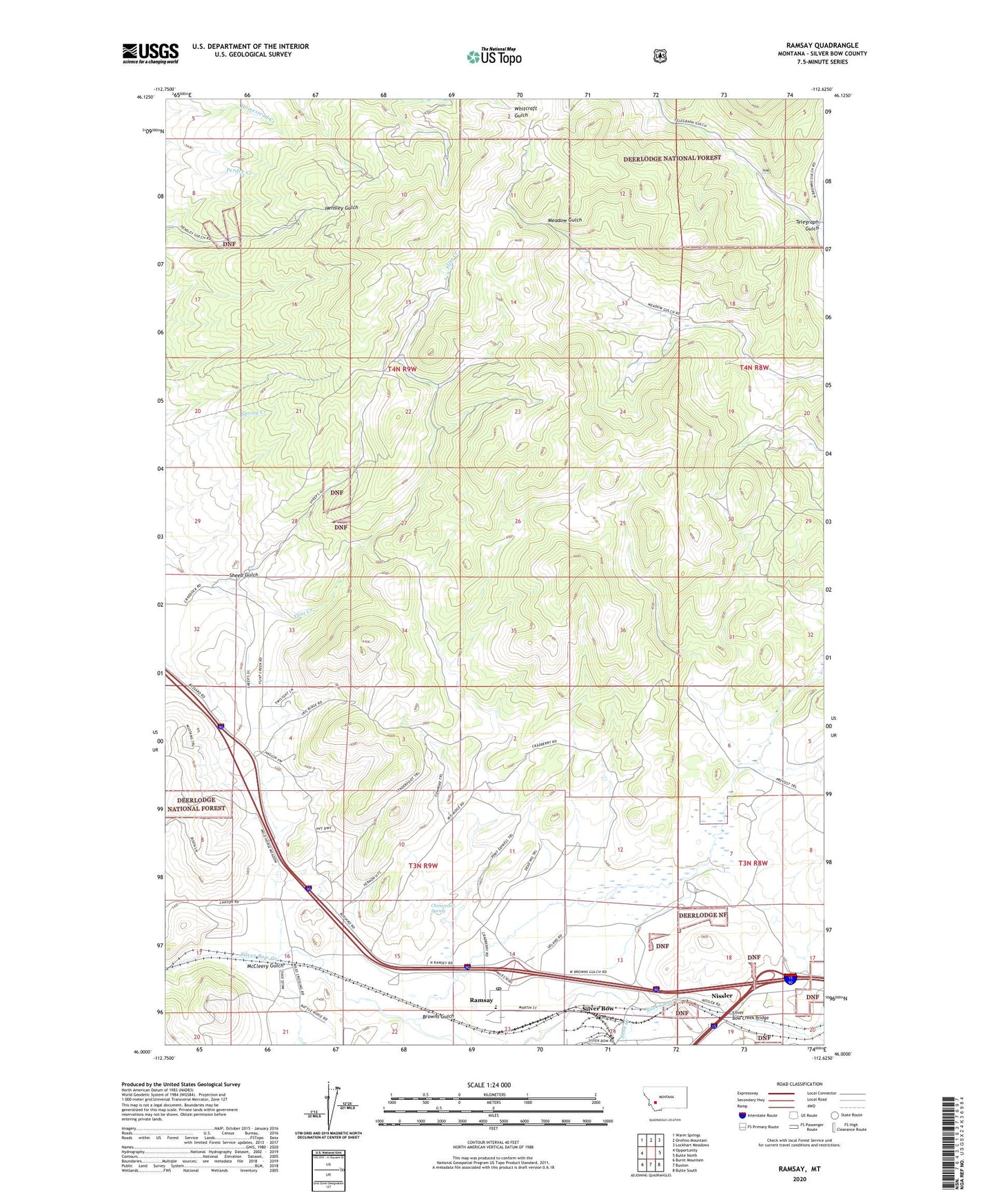
2024 topographic map quadrangle Ramsay in the state of Montana. Scale: 1:24000. Based on the newly updated USGS 7.5' US Topo map series, this map is in the following counties: Silver Bow. The map contains contour data, water features, and other items you are used to seeing on USGS maps, but also has updated roads and other features. This is the next generation of topographic maps. Printed on high-quality waterproof paper with UV fade-resistant inks.
Quads adjacent to this one:
West: Opportunity
Northwest: Warm Springs
North: Orofino Mountain
Northeast: Lockhart Meadows
East: Butte North
Southeast: Butte South
South: Buxton
Southwest: Burnt Mountain
This map covers the same area as the classic USGS quad with code o46112a6.
Contains the following named places: 03N10W02CDAB01 Well, 04N09W04DD__01 Well, 04N09W05CD__01 Well, 59748, Browns Gulch, Butte and Zenith Mine, Butte-Silver Bow Northwest Division, Chinamans Spring, Dawson, KXTL-AM (Butte), McCleery Gulch, McMinnville, Miles, Miles Crossing, NE SW Section 22 Mine, Nissler, Ramsay, Ramsay Post Office, Ramsay School, Ross, Sand Creek, Sheep Gulch, Silver Bow, Silver Bow Creek Bridge, Telegraph Gulch, Tuxedo Mine