
MyTopo
Loma West Montana US Topo Map
Couldn't load pickup availability
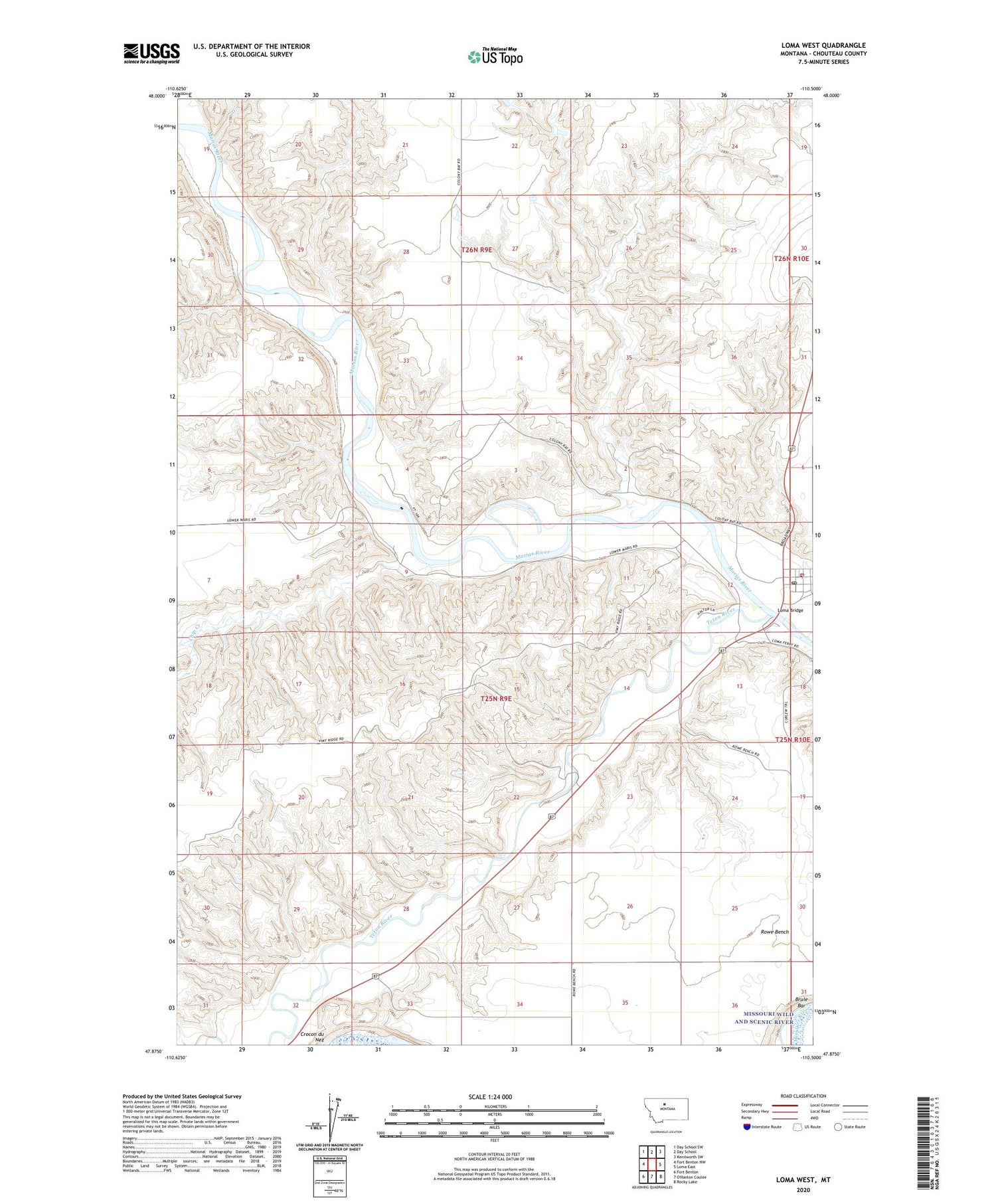
2020 topographic map quadrangle Loma West in the state of Montana. Scale: 1:24000. Based on the newly updated USGS 7.5' US Topo map series, this map is in the following counties: Chouteau. The map contains contour data, water features, and other items you are used to seeing on USGS maps, but also has updated roads and other features. This is the next generation of topographic maps. Printed on high-quality waterproof paper with UV fade-resistant inks.
Quads adjacent to this one:
West: Fort Benton NW
Northwest: Day School SW
North: Day School
Northeast: Kenilworth SW
East: Loma East
Southeast: Rocky Lake
Southwest: Fort Benton
Contains the following named places: 25N09E09DBAD01 Well, Brule Bar, Chip Creek, Collins School, Dry Fork Coulee, Fisher Coulee, Fort Brule, Loma, Loma Bridge, Loma Bridge Fishing Access Site, Loma Earth Science Museum, Loma Post Office, Loma Rural Volunteer Fire Department, Loma School, Marias, Marias River Historical Marker, Rowe Bench, Teton Post Office, Teton River, Teton Station, Vimy Ridge


