MyTopo
Fort Benton Montana US Topo Map
Couldn't load pickup availability
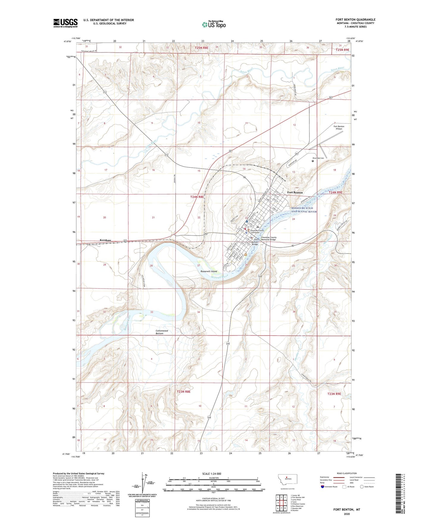
2024 topographic map quadrangle Fort Benton in the state of Montana. Scale: 1:24000. Based on the newly updated USGS 7.5' US Topo map series, this map is in the following counties: Chouteau. The map contains contour data, water features, and other items you are used to seeing on USGS maps, but also has updated roads and other features. This is the next generation of topographic maps. Printed on high-quality waterproof paper with UV fade-resistant inks.
Quads adjacent to this one:
West: Tunis
Northwest: Carter NE
North: Fort Benton NW
Northeast: Loma West
Southeast: Shonkin
South: Shonkin NW
Southwest: Rice Reservoir
This map covers the same area as the classic USGS quad with code o47110g6.
Contains the following named places: 23N08E12CACA01 Well, 24N08E26BCCA01 Well, 24N08E26BDBA01 Well, Agricultural Museum and Center of Montana, Benton Eye Clinic, Benton Medical Clinic, Benton RV Park, Chinaman Hill, Chouteau County Courthouse, Chouteau County Fairgrounds, Chouteau County Free Library, Chouteau County Memorial Bridge, Chouteau County Sheriff's Office, City of Fort Benton, Community Bible Church, Cottonwood Bottom, D and S RV Park, First Christian Church, First Lutheran Church, Fort Benton, Fort Benton Airport, Fort Benton Ambulance Service, Fort Benton Bridge, Fort Benton City Park Rest Area, Fort Benton Elementary School, Fort Benton High School, Fort Benton Historical Marker, Fort Benton Police Department, Fort Benton Post Office, Fort Benton Sewage Lagoon Dam, Fort Benton United Methodist Church, Fort Benton Volunteer Fire Department, Fort Campbell, Fort Cotton, Fort LaBarge, Fort Lewis, General Mills Incorporated Elevator, Hankins Number 1 Dam, Immaculate Conception Catholic Church, Kershaw, Lewis and Clark State Memorial, Missouri River Medical Center, Missouri River Medical Center Nursing Home, Museum of the Northern Great Plains, Museum of the Upper Missouri, Peavey Company Grain Elevator, Riverside Cemetery, Roosevelt Island, Saint Pauls Episcopal Church, Shep Memorial, Signal Point Golf Club, The Canyon, The Church of Jesus Christ of Latter Day Saints, Whoop-Up Trail Monument, World War I Memorial