
MyTopo
Long Creek West Montana US Topo Map
Couldn't load pickup availability
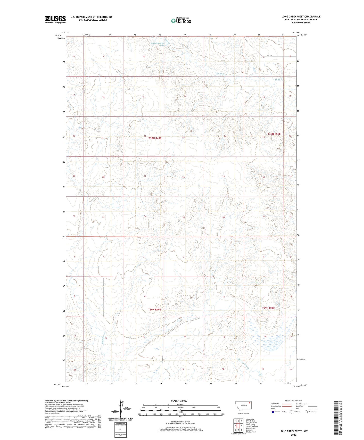
2020 topographic map quadrangle Long Creek West in the state of Montana. Scale: 1:24000. Based on the newly updated USGS 7.5' US Topo map series, this map is in the following counties: Roosevelt. The map contains contour data, water features, and other items you are used to seeing on USGS maps, but also has updated roads and other features. This is the next generation of topographic maps. Printed on high-quality waterproof paper with UV fade-resistant inks.
Quads adjacent to this one:
West: Sims Spring
Northwest: Bears Nest
North: Windy Butte
Northeast: Hay Creek NW
East: Long Creek East
Southeast: Badger Creek
South: Chelsea
Southwest: Chelsea NW
Contains the following named places: 29N50E05CC__01 Well, 30N49E11BBCD01 Spring, 30N49E12CCCC01 Well, 30N49E27DCBB01 Well, 30N49E36DCCC01 Well, 30N50E30ADBB01 Well, 30N50E30BAAA01 Well, 30N50E32BDBC01 Well, Cosier Post Office, Fort Peck Reservation Division, Poplar District, Reservation School, Structure Number 124 Dam


