MyTopo
Windy Butte Montana US Topo Map
Couldn't load pickup availability
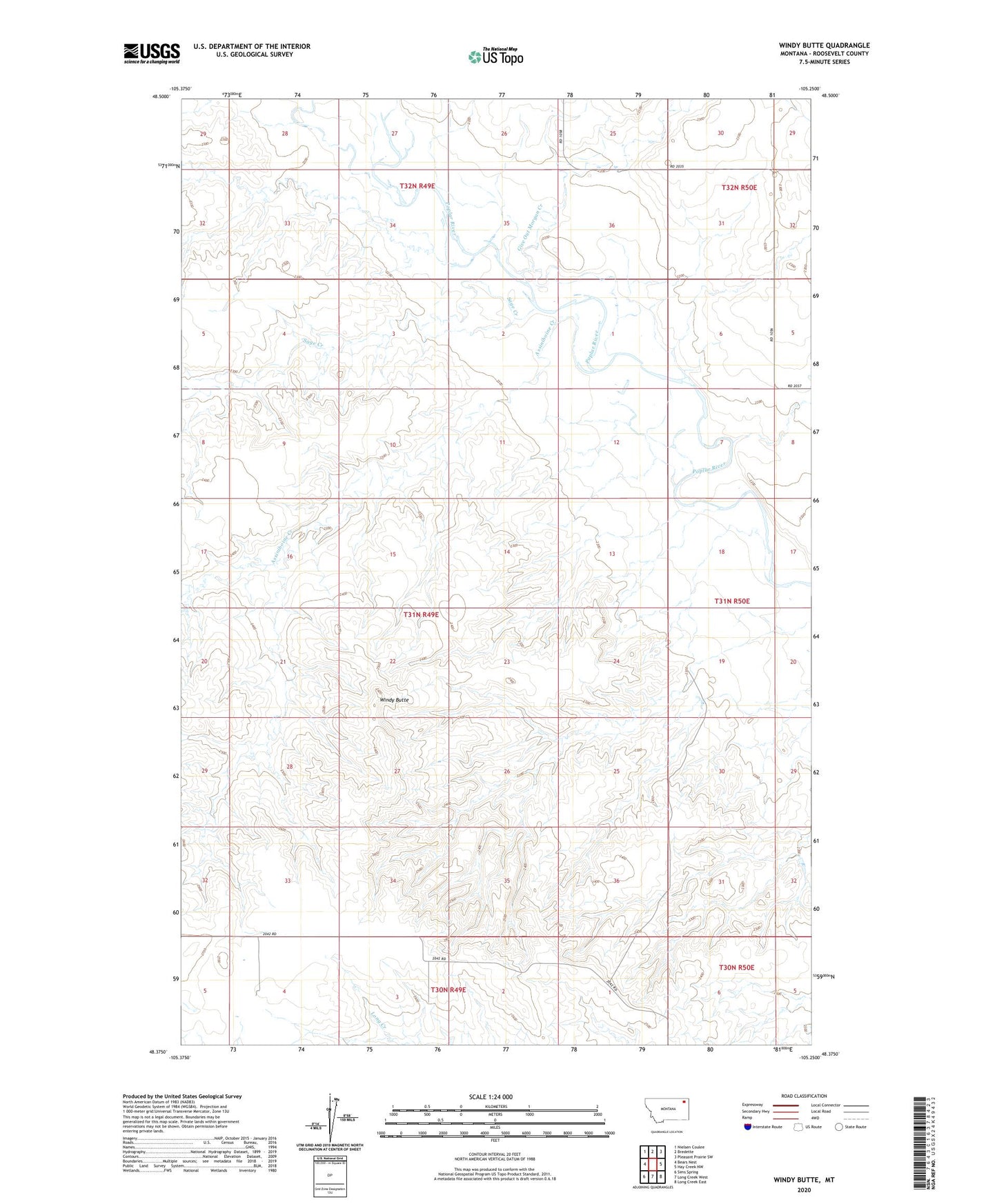
2024 topographic map quadrangle Windy Butte in the state of Montana. Scale: 1:24000. Based on the newly updated USGS 7.5' US Topo map series, this map is in the following counties: Roosevelt. The map contains contour data, water features, and other items you are used to seeing on USGS maps, but also has updated roads and other features. This is the next generation of topographic maps. Printed on high-quality waterproof paper with UV fade-resistant inks.
Quads adjacent to this one:
West: Bears Nest
Northwest: Nielsen Coulee
North: Bredette
Northeast: Pleasant Prairie SW
East: Hay Creek NW
Southeast: Long Creek East
South: Long Creek West
Southwest: Sims Spring
This map covers the same area as the classic USGS quad with code o48105d3.
Contains the following named places: 30N49E03ABDD01 Well, 31N49E11BACB01 Well, 31N49E11BBD_01 Well, 31N49E25BBCB01 Well, Assiniboine Creek, Cusker School, Cuskers House, Cuskerton Post Office, Give Out Morgan Creek, Hughes School, J B Airport, Rush School, Sage Creek, Thompson School, Windy Butte